
Elevation 618 m | Prominence 512 m | |
 | ||
Similar Tiger Mountain, Cougar Mountain, Mount Si, Rattlesnake Ridge, Chopaka Mountain | ||
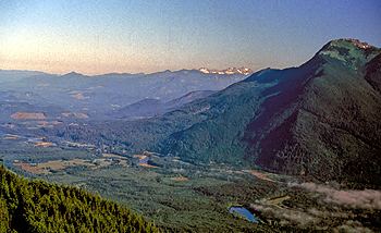
Squak Mountain is the second most westerly mountain of the Issaquah Alps mountain chain in Washington state. It is situated between Cougar Mountain to the west and Tiger Mountain to the east. Interstate 90 parallels the base of the north side of the mountain. Much of the Squak Mountain watershed drains into Lake Sammamish. Most of the mountain is protected by Squak Mountain State Park and Cougar/Squak and Squak/Tiger Corridors of King County.
Contents
Map of Squak Mountain, Washington 98027, USA
Squak Mountain actually consists of three major peaks: the Central Peak (Elevation 2024 feet), the West Peak (Elevation 1995 feet), and the Southeast Peak (Elevation 1673 feet).
The name "Squak" comes from the Southern Lushootseed placename /sqʷásxʷ/, which is also the source of the name Issaquah Creek and the city of Issaquah.
History
Squak Mountain first appears in the history of European settlement after the discovery of coal on the mountain in 1859. This helped fuel the establishment of the first commercial coal mine in Issaquah, WA in 1862 and in Renton, WA in 1863. While there is no longer coal mining on Squak Mountain, the dangers posed by abandoned mines are one reason it has been preserved from development.
Squak Mountain State Park was formed in 1972. The initial land grant of 590 acres to form the park was made by the Bullitt family. The initial grant was near the top and specified that the land remain in its natural state. These stipulations can still be seen today in the greater restrictions in park usage at the top of the mountain, on the original Bullitt family parcel. The remains of the Bullitt family home (just a foundation and fireplace) can be found in this original parcel.
Over time, the park has expanded to its current size of 1,545-acres through the acquisition of additional parcels of land.
While generally a quiet and safe park, Squak Mountain has seen mayhem over the years.
The Park
The well-signed trail system consists mostly of abandoned roads that are narrowing to single-track trails, more so each year. One such road-trail leads to a foundation and fireplace that is the remnant of the Bullitt family summer home. Distant views are infrequent because of the forest. The major attraction of Squak Mountain is its urban wilderness.
Trails
Squak Mountain State Park features the following trails:
Residential development in Issaquah extends to the park boundary to and elevation of about 1,100 feet (340 m). The park is accessed from a trailhead (elevation 740 ft or 230 m) at the hairpin turn of Mountainside Drive in the north, and the signed state park entrance on May Valley Road in the south (elevation 350 ft or 110 m). A lesser trailhead is found on the Renton-Issaquah Road on the west (elevation 400 ft or 120 m). Other trailheads may be reached via Sycamore Drive SE and Sunrise Place SE.