
Country Canada Local time Wednesday 5:22 AM | ||
 | ||
Weather 6°C, Wind SE at 11 km/h, 93% Humidity | ||
Cn cab ride fraser thompson canyon boston bar to spences bridge 10
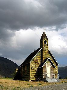
Spences Bridge is a community in the Canadian province of British Columbia, situated 35 km (22 miles) north east of Lytton and 44 km (27 miles) south of Ashcroft. In 1892, the population included 32 people of European ancestry and 130 First Nations people. There were 5 general stores, 3 hotels, one Church of England and one school. The principal industries are fruit growing and farming. The population today is "approximately 138."
Contents
- Cn cab ride fraser thompson canyon boston bar to spences bridge 10
- Map of Spences Bridge BC Canada
- British columbia motorcycle ride merritt to spences bridge
- History
- Locations
- Climate
- Pioneers of Spences Bridge
- References
Map of Spences Bridge, BC, Canada
British columbia motorcycle ride merritt to spences bridge
History
The Kettle Valley Railway included a spur line stretching from Merritt to Spence's Bridge. The rail bed is still intact along with the original bridges.
On January 1, 2014, the old Spences Bridge, which was a one-lane steel truss bridge was decommissioned and permanently closed to all pedestrian and vehicle traffic after 82 years of service. This was deemed necessary by British Columbia Ministry of Transportation engineers.
Locations
North of Spences Bridge is Ashcroft (44 km) and Cache Creek (50 km). Also north is 100 Mile House (162 km), Williams Lake (254 km), Quesnel (371 km), and Prince George (492 km). South of Spences Bridge is Lytton (35 km), Hope (143 km), and Vancouver (295 km). East of the town is Merritt (65 km) and Kelowna (192 km).
Spences Bridge's location is mountainous, with higher elevations part of the Interior Plateau. The west side of the Fraser here is part of the Clear Range, a mountainous southwards extension of the Fraser Plateau located in the angle of the Thompson and Fraser Rivers. Arthur Seat lies in that range on the west side of Spences Bridge, and was named by pioneer John Murray for the similarly-named mountain in Edinburgh, Scotland.
Climate
Spences Bridge has a semi-arid climate (Köppen climate classification BSk). The climate is very dry and mild by Canadian standards, with an average annual precipitation of just 269.1 mm (10.6 in). Winters are short and moderately cold for usually brief periods and sunshine hours are very low for a couple of months, while summers are quite long, hot, sunny and dry –compared to the rest of Canada, albeit with comfortable nights. Like much of the lower-altitude valleys in the Thompson Nicola region, there are more days (on average approx. 40 days per year) when temperature exceeds 32 °C (90 °F) than remain below freezing.