
Municipality ID NO-1731 Local time Wednesday 3:32 AM | Adm. Center Sparbu Area 259 km² | |
 | ||
Created as Formannskapsdistrikt in 1838 Weather -1°C, Wind S at 8 km/h, 87% Humidity | ||
Sparbu is a village and former municipality in Nord-Trøndelag county, Norway. It is located in the present-day municipality of Steinkjer. The 0.39-square-kilometre (96-acre) village has a population (2013) of 592. The population density of Sparbu is 1,518 inhabitants per square kilometre (3,930/sq mi).
Contents
Map of 7710 Sparbu, Norway
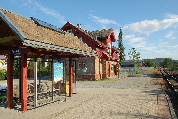
Sparbu sits along European route E6, and it is also the location of Sparbu Station on the Nordland Line. The village of Mære lies about 2 kilometres (1.2 mi) to the north, the village of Røra lies about 8 kilometres (5.0 mi) to the south, and the lake Leksdalsvatnet lies about 8 kilometres (5.0 mi) to the east.
History
The parish of Sparbu was established as a municipality on 1 January 1838 (see formannskapsdistrikt). The eastern district of Skei (population: 1,441) was separated from Sparbu on 1 January 1885 to form a municipality of its own. This left Sparbu with 2,842 residents. On 1 January 1964, a major municipal merger took place: the municipalities of Sparbu, Ogndal, Beitstad, Egge, Kvam, and Stod were all merged with the town of Steinkjer to form the new municipality of Steinkjer. Prior to the merger, Sparbu had 4,027 inhabitants.