
Area 378.2 km² | Population 11,119 Islands Culebra | |
 | ||
Largest settlement Isabel Segunda (pop. 1459) Pop. density 29.27 /km (75.81 /sq mi) Similar Culebrita, Cayo Luis Peña, Isla Palomino, Culebra National Wildlife R, Flamenco Beach | ||
Spanish virgin islands isla culebrita webeyachting com gopro dji
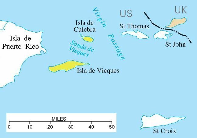
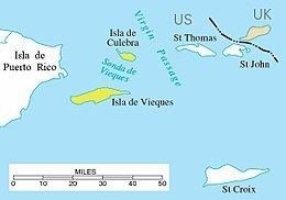
The Spanish Virgin Islands, formerly called the Passage Islands and also known as the Puerto Rican Virgin Islands, primarily consisting of the islands of Culebra and Vieques, are part of the Commonwealth of Puerto Rico, and are located east of the main island of Puerto Rico in the Caribbean.
Contents
Geography
Puerto Rican tourist literature uses the name Spanish Virgin Islands, but most general maps and atlases do not treat these islands as part of the Virgin Islands archipelago. As part of Puerto Rico, the Passage Islands are part of a territory of the United States, and they belonged to Spain before the Spanish–American War in 1898. Spanish remains the predominant language, although English is also common.
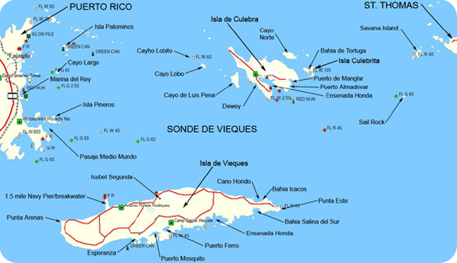
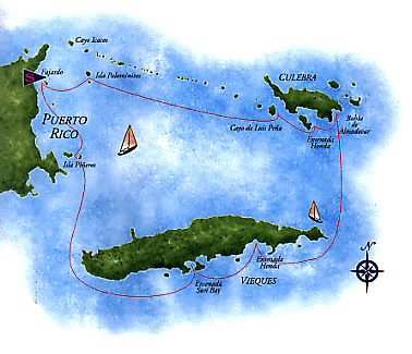
The principal islands of the group are Culebra and Vieques, with multiple associated smaller islands and islets. Other islands that are close to the shore of Puerto Rico include: Icacos Island, Cayo Lobo, Cayo Diablo, Palomino Island, Palominito Island, Isla de Ramos, Isla Pineiro, Cayo Lobo. Near Culebra there is Cayo de Luis Pena (named after the second owner).
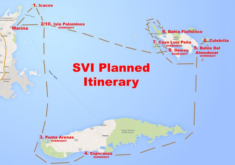
Culebra's smaller island, Cayo Norte, is part of Culebra National Wildlife Refuge. Much of Vieques is part of Vieques National Wildlife Refuge, formerly a U.S. Navy facility.
Flora and fauna
The fauna in the Spanish Virgin Islands is not very diverse.