
OS grid reference SK8369 Post town NOTTINGHAM | Sovereign state United Kingdom Postcode district NG23 | |
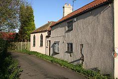 | ||
Spalford is a hamlet and civil parish in the Newark and Sherwood district of Nottinghamshire, England. Spalford was listed in the Domesday Book (1086) as 'Spaldesforde'.
Contents
Map of Spalford, Newark, UK
The hamlet is located between South Clifton and Weecar near to the county boundary with Lincolnshire, north of Newark-on-Trent.
According to the 2001 census it had a population of 85.
To the west of the parish is the River Trent, and to the south is the Local nature reserve and Site of Special Scientific Interest known as Spalford Warren. The reserve habitat being made up of blown sand heathland, which is rare in Nottinghamshire.
Spalford Floodbank
In 1795 during the largest known flood on the Trent, the floodbank which is situated between Spalford and the river was breached. Floodwaters from the breach spread out across the low lying land, even reaching the River Witham and flooding Lincoln. Some 20,000 acres were flooded for a period of over three weeks. A description of the breach was given as follows:
“The bank is formed upon a plain of sandy nature, and when it was broken in 1795, the water forced an immense breach, the size of which may be judged from the fact that eighty loads of faggots and upwards of four hundred tons of earth were required to fill up the hole, an operation which took several weeks to complete.”
The flood bank was subsequently strengthened and repaired, following further Trent floods in 1824 and 1852.