
Country United States Incorporated 1890 Elevation 332 m Population 2,120 (2013) | Settled 1769 Time zone Eastern (EST) (UTC-5) Zip code 15601 Local time Tuesday 11:03 AM | |
 | ||
Weather 14°C, Wind SW at 10 km/h, 92% Humidity | ||
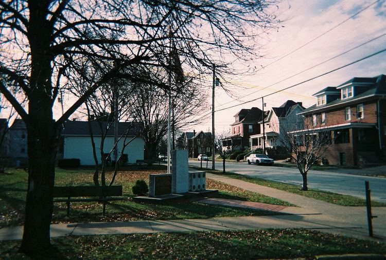
Southwest Greensburg is a borough in Westmoreland County, Pennsylvania, United States. The population was 2,398 at the 2000 census.
Contents
- Map of Southwest Greensburg PA 15601 USA
- History
- Geography
- Demographics
- Culture and Recreation
- References
Map of Southwest Greensburg, PA 15601, USA
History
In 1769, John Peter Miller was granted provisional ownership of land within the current-day boundaries of Southwest Greensburg, and he received full ownership rights in 1789. Miller was told that the first settler traditionally has the right to name a community, and when Miller was asked what name he preferred for the area, he responded with "What you please?" As a result, the community - at that point a mere collection of farms - bore the unusual name "What You Please?" for many decades, in what was undoubtedly an expression of settlers' sense of humor.
In 1887, Richard Coulter and George Franklin Huff, both of whom had attained wealth in the local coal industry, saw the possibilities of developing the area as a residential community. Coulter and Huff purchased land from a farmer, John Mace, in 1887, and a community was laid out consisting of 413 lots. The first recorded use of the name "Southwest Greensburg" occurred in 1888, when Coulter and Huff's plan was submitted to the county courthouse.
Southwest Greensburg was incorporated as a borough on November 15, 1890. The first borough election was held on February 17, 1891, in which John Putnam was elected as the borough's first burgess (mayor), together with other borough officials.
A key element of the community's development was the Greensburg & Hempfield Street Railway, which built a trolley line on Greene Street in 1890. Shortly afterward, the company built an amusement park called "Electric Park" to increase trolley traffic. The boundaries of "Electric Park" were (approximately) Greene Street, Main Street, Welty Street, and Weaver Street. Nothing of "Electric Park" remains, which was eventually redeveloped as residential lots. The trolley line itself was later acquired by West Penn Railways and operated until January 3, 1937.
Geography
Southwest Greensburg is located at 40°17′36″N 79°32′55″W.
According to the United States Census Bureau, the borough has a total area of 0.4 square miles (1.0 km2), all of it land.
Demographics
As of the census of 2000, there were 2,398 people, 1,097 households, and 645 families residing in the borough. The population density was 6,001.9 people per square mile (2,314.7/km2). There were 1,187 housing units at an average density of 2,970.9 per square mile (1,145.8/km2). The racial makeup of the borough was 96.62% White, 1.75% African American, 0.13% Native American, 0.17% Asian, 0.04% Pacific Islander, 0.38% from other races, and 0.92% from two or more races. Hispanic or Latino of any race were 0.46% of the population. There were 1,097 households out of which 24.2% had children under the age of 18 living with them, 44.2% were married couples living together, 11.9% had a female householder with no husband present, and 41.2% were non-families. 36.0% of all households were made up of individuals and 14.3% had someone living alone who was 65 years of age or older. The average household size was 2.19 and the average family size was 2.85.
In the borough the population was spread out with 21.1% under the age of 18, 7.4% from 18 to 24, 32.2% from 25 to 44, 22.1% from 45 to 64, and 17.2% who were 65 years of age or older. The median age was 39 years. For every 100 females there were 89.4 males. For every 100 females age 18 and over, there were 85.8 males.
The median income for a household in the borough was $35,750, and the median income for a family was $43,929. Males had a median income of $31,219 versus $24,613 for females. The per capita income for the borough was $18,281. About 5.8% of families and 6.8% of the population were below the poverty line, including 7.1% of those under age 18 and 9.4% of those age 65 or over.
Culture and Recreation
In spite of its sleepy appearance, there are opportunities for a little bit of recreation in this quiet neighborhood. Amos K. Hutchinson Elementary School offers a playground, basketball court, and a baseball field. In the autumn, one should not be surprised to find an intense American football match raging at the school in the evenings. Also, Red Devil's Field is a mecca for fans of amateur baseball who are in the area.