
Country United States FIPS code 36-69617 Elevation 327 m Local time Tuesday 10:05 AM | State New York Time zone Eastern (EST) (UTC-5) GNIS feature ID 0979509 Population 10,940 (2010) | |
 | ||
Weather 10°C, Wind SE at 2 km/h, 87% Humidity Area 121.2 km² (120.2 km² Land / 104 ha Water) | ||
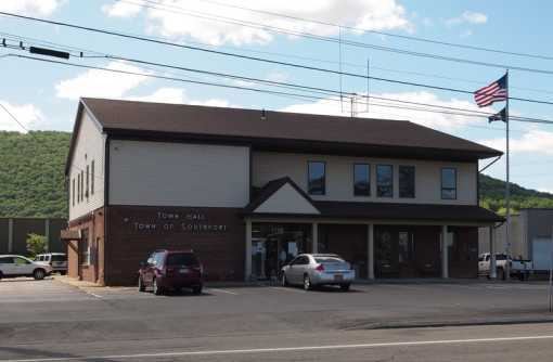
Southport is a town in Chemung County, New York, United States. The population was 10,940 at the 2010 census. The town is located in the southwest corner of Chemung County and is southwest of the city of Elmira. It is part of the Elmira Metropolitan Statistical Area.
Contents
Map of Southport, NY, USA
History
The area was first settled around 1788. The town of Southport was formed from the town of Elmira in 1822. In 1867, an eastern section of the town was used to form part of the new town of Ashland.
Geography
According to the United States Census Bureau, Southport has a total area of 46.8 square miles (121.3 km2), of which 46.4 square miles (120.2 km2) is land and 0.42 square miles (1.1 km2), or 0.91%, is water.
The south town line is the border of Pennsylvania, and the west town line is the border of Steuben County, New York. The Chemung River, a tributary of the Susquehanna River, forms part of the northern border.
New York State Route 14 and New York State Route 328 are north-south highways that intersect in Southport village.
Demographics
As of the census of 2000, there were 11,185 people, 4,189 households, and 2,890 families residing in the town. The population density was 240.4 people per square mile (92.8/km²). There were 4,353 housing units at an average density of 93.6 per square mile (36.1/km²). The racial makeup of the town was 90.55% White, 6.78% Black or African American, 0.19% Native American, 0.23% Asian, 0.04% Pacific Islander, 1.47% from other races, and 0.75% from two or more races. Hispanic or Latino of any race were 2.91% of the population.
There were 4,189 households out of which 28.6% had children under the age of 18 living with them, 54.7% were married couples living together, 10.4% had a female householder with no husband present, and 31.0% were non-families. 26.2% of all households were made up of individuals and 12.3% had someone living alone who was 65 years of age or older. The average household size was 2.42 and the average family size was 2.89.
In the town, the population was spread out with 21.2% under the age of 18, 8.1% from 18 to 24, 29.3% from 25 to 44, 24.6% from 45 to 64, and 16.7% who were 65 years of age or older. The median age was 40 years. For every 100 females there were 109.1 males. For every 100 females age 18 and over, there were 111.2 males.
The median income for a household in the town was $38,580, and the median income for a family was $44,232. Males had a median income of $32,144 versus $24,410 for females. The per capita income for the town was $18,454. About 8.7% of families and 11.7% of the population were below the poverty line, including 18.5% of those under age 18 and 4.2% of those age 65 or over.