
Official name Lake Mitchell Dam Status Operational Length 530 m Catchment area 321 km² Construction began 1986 | Country Australia Opening date 1987 (1987) Surface elevation 375 m Surface area 32.9 km² | |
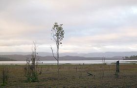 | ||
The Southedge Dam, also known as the Lake Mitchell Dam, is an earth filled embankment dam across the Mitchell River located in Far North Queensland, Australia. Opened in 1987 as an ornamental lake, the impoundment created by the dam is called Lake Mitchell and at full supply level has an active capacity of 129,000 megalitres (28×10^9 imp gal; 34×10^9 US gal).
Contents
Map of Lake Mitchell, Southedge QLD 4871, Australia
Location and features
Commenced in 1986 and opened a year later, the Southedge Dam wall consists of an earth-fill embankment 530 metres (1,740 ft) in length and 16.5 metres (54 ft) high. The reservoir has a catchment area of 321 square kilometres (124 sq mi). The reservoir has a total capacity of 190,000 ML (42,000,000×10^3 imp gal; 50,000,000×10^3 US gal) of water; and covers an area of 3,290 ha (8,100 acres). Southedge Dam has remained unused since it was opened in 1987; constructed and owned by Southedge Pastoral Company.
When the dam spills over it flows into the Mitchell River.