
Country New Zealand Seat Martinborough Area 2,485 km² Area code 06 | Region Wellington Time zone NZST (UTC+12) Local time Tuesday 7:08 PM | |
 | ||
Wards List
Martinborough
Featherston
Greytown Postcode(s) 5710, 5711, 5712, 5740, 5741, 5742, 5771, 5772, 5773, 5781, 5782, 5783, 5784, 5794 Weather 16°C, Wind SE at 14 km/h, 75% Humidity Points of interest Putangirua Pinnacles, Fell Locomotive Museum, Cobblestones Museum, Cape Palliser Lighthouse, Muirlea Rise | ||
Nz skate park ep 06 featherston skate park spot check south wairarapa district
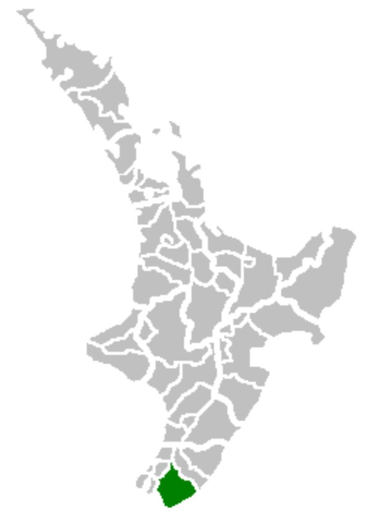
South Wairarapa District is at the south-east tip of the North Island of New Zealand.
Contents
- Nz skate park ep 06 featherston skate park spot check south wairarapa district
- Map of South Wairarapa District Wellington New Zealand
- Introduction
- Topography
- Local and regional government
- Other information
- References
Map of South Wairarapa District, Wellington, New Zealand
Introduction
South Wairarapa includes three towns and several localities that have a wide range of economic activity, natural features, and visitor attractions, only a few of which are noted here. Martinborough is the seat of the SWDC and is a nationally important wine-producing area. The town's central streets form a Union Flag pattern. Greytown is where Arbor Day was first celebrated in New Zealand). Featherston has a museum displaying the world's only Fell Locomotive Railway Engine.
Because of South Wairarapa's proximity to the capital city of New Zealand, Wellington, there are close links between the two areas. For example, some people live in South Wairarapa and commute to Wellington each day to work; others live and work in Wellington while spending weekends in South Wairarapa.
Topography
The topography of South Wairarapa includes the floodplain of the Ruamahanga River and the associated Lake Wairarapa, as well as the long southern stretch of Palliser Bay. To the west of the plains rise the eastern slopes of the Rimutaka Range, the crest of which forms the western boundary of the district, while the Aorangi Range lies to the southeast. The southernmost point of the North Island, Cape Palliser is in the South Wairarapa.
Local and regional government
The South Wairarapa District Council (SWDC) is the territorial authority responsible for the area. For the purposes of local government, Wairarapa is divided into the Masterton district, the Carterton district, and the South Wairarapa district. For the purposes of regional government, Wairarapa is included in the Wellington region along with Kapiti, Porirua, the Hutt Valley, and Wellington, and governed by the Greater Wellington Regional Council.
Other information
Shibboleth: Some New Zealanders refer to "The Wairarapa", rather than just "Wairarapa", and this usage carries over to the constituent parts of the district. Thus, South Wairarapa is sometimes referred to as The South Wairarapa.