
Population 5,225 (2011 census) Postal code 4350 | Postcode(s) 4350 Area 3.7 km² | |
 | ||
Location 2 km (1 mi) S of Toowoomba | ||
South Toowoomba is an inner suburb of Toowoomba, Queensland, Australia, located directly south of the city centre. At the 2011 Australian Census the suburb recorded a population of 5,225.
Contents
Map of South Toowoomba QLD 4350, Australia
The suburb is home to St Patricks Cathedral, City Golf Course, the Downs Shopping Centre and St Saviour's College.
Attractions
Education
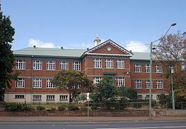
Heritage listings
South Toowoomba has a number of heritage-listed sites, including:
References
South Toowoomba, Queensland Wikipedia(Text) CC BY-SA