
Status District HQ Ludlow | ONS code 39UF Date dissolved 2009 | |
 | ||
Government South Shropshire District Council | ||
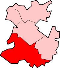
South Shropshire was, between 1974 and 2009, a local government district in south west Shropshire, England.
Contents
South Shropshire was the most rural district of one of the UK's most rural counties, the population of the district was 40,410 in 2001 spread out over 1,027 km² of forest, mountains, moorlands, hills and mixed quality farmland. It bordered the unitary authority of Powys in Wales, which it closely resembles, economically, socially, culturally and historically. 65% of the district is part of the Shropshire Hills Area of Outstanding Natural Beauty. Only the towns of Ludlow and Church Stretton have populations in excess of 3000. Other towns formerly in the district were Clun, Bishop's Castle, Cleobury Mortimer and Craven Arms.
The district was formed by the merger of the rural districts of Clun and Bishop's Castle and Ludlow in 1974, under the Local Government Act 1972.
The district and its council were abolished on 1 April 2009 when the new Shropshire unitary authority was established, as part of the 2009 structural changes to local government in England.
Economics and Demographics
Economically the district was largely dependent on tourism, partly due to the decline in the economic significance of farming and also the decline and subsequent end of local lead and coal mining industry. In addition to tourism, some light industry did exist in the district, in the Church Stretton and Ludlow areas, and in Burford, near Tenbury Wells.
Some statistics for the local area suggest that wages are "low", but also that the rate of unemployment is below average.
Additionally, the local demographics show a large economic gap between affluent residents and poorer communities. Many of the affluent residents have moved into the area from other places, such as South East England on their retirement. This continues an older trend whose root was initially in the imbalance of wealth associated with the farming economy previously prevalent in the area.
Geography
The District of South Shropshire covered an area of 1,028 square kilometres, or 397 square miles (1,030 km2), which was roughly one third of the administrative county of Shropshire as of 2008.
South Shropshire is a land of mountains, valleys, hills, moors, forests and low grade farmland. The landscape is often rugged, with crags and rock outcrops very common, especially in the west and around the Clee Hills, and was for the most part gouged by glaciers during the ice age. It contains a myriad of rock types, and is widely regarded as the geological capital of the UK, with Wenlock Edge being especially highly regarded by geologists.
See the Shropshire Hills AONB (Area of Outstanding Natural Beauty) for more about the natural geography of the area.
History
South Shropshire is littered with ancient monuments, with Mitchells Fold on the Welsh border being the most notable, and there is evidence of Neolithic quarrying in the Apedale. The area seems to have been settled by the Ordovices, an Iron Age tribe of people in the last millennium BC, and was a stronghold of the Celtic chieftain Caractacus (Caer Caradoc is said to be named after him). The area was probably part of the "Military" division of the Roman occupation and locals claim that the Romans mined lead in the north west of the district.
In the Early Middle Ages, the area was a battleground between the Welsh and the Anglo Saxon Kingdom of Mercia and Offa's Dyke, which is partially in the district, is a permanent reminder of the areas border status.
In the Middle Ages, South Shropshire was part of the Welsh Marches, a lawless area ruled by tyrannical feudal lords, who as Marcher Lords had de facto independence from the King of England. It has been remarked that the attitude of the time lives on in the areas mistrust of outside control. During the English Civil War the area was generally spared from fighting, although there was a small massacre at Hopton Castle.
During the Industrial Revolution, coal was mined around Clee Hill and lead was mined near the border with Wales, e.g. at Snailbeach. Church Stretton was a centre of textile manufacture and Ludlow thrived on the malting trade, while the rest of the area was populated by smallholders. The economy of the area was fragile, and most industry in the area had collapsed by 1900.
Politics
The last South Shropshire District Council was controlled by the Conservative Party, with the second largest party being the Liberal Democrats. A number of independent politicians also held seats in the council. The Labour Party had not contested recent elections within the district.
Energy policy
In May 2006, a report commissioned by British Gas [1] showed that housing in South Shropshire produced the 13th highest average carbon emissions in the country at 7,156 kg of carbon dioxide per dwelling.