
OS grid reference TF369757 Local time Tuesday 4:22 AM | Sovereign state United Kingdom Postcode district LN11 | |
 | ||
Weather 5°C, Wind E at 8 km/h, 97% Humidity | ||
South Ormsby, sometimes called South Ormesby, is a village in the East Lindsey district of Lincolnshire, England. It is situated 1 mile (1.6 km) west from the A16 road, 7 miles (11 km) south from Louth and 7 miles north-east from Horncastle. With the nearby hamlet of Ketsby, it forms the civil parish of South Ormesby with Ketsby. The population is included in the civil parish of Brinkhill.
Map of South Ormsby, Louth, UK
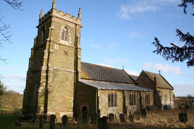
The 15th-century church of St Leonard's is approached by a short climb up a path next to the old school house.
Ormsby Hall, built by James Paine in 1752, stands in a wooded parkland complete with lake.
The village has a public house, the Massingberd Arms, and a motor repair garage.
The Greenwich Prime Zero meridian line passes through the village.
References
South Ormsby Wikipedia(Text) CC BY-SA