
OS grid reference TF368765 | Sovereign state United Kingdom Postcode district LN11 | |
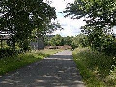 | ||
Ketsby is a hamlet in the civil parish of South Ormsby in the East Lindsey district of Lincolnshire, England. It is situated 5 miles (8.0 km) west from the town of Alford. The population of the hamlet is included in the civil parish of Brinkhill.
Map of Ketsby, Louth, UK
Ketsby is listed in the Domesday account with 18 households, a meadow of 60 acres (0.24 km2) and a mill.
An early medieval cresset lamp, with a maltese cross carved on the base, was found at Ketsby and is now in Lincoln City and County Museum.
Ketsby water mill and mill house are built in yellow brick, date from 1864, and are Grade II listed buildings. The mill is no longer in operation.
The Greenwich Prime Zero meridian line passes through the hamlet.
References
Ketsby Wikipedia(Text) CC BY-SA