
Country Botswana | Area 1,780 km² | |
 | ||
Points of interest Mokolodi Nature Reserve, Botswana National Museum, Three Dikgosi Monument, Gaborone Game Reserve, National Botanical Garden Colleges and Universities University of Botswana, Botswana College of Agriculture, Botswana Accountancy College | ||
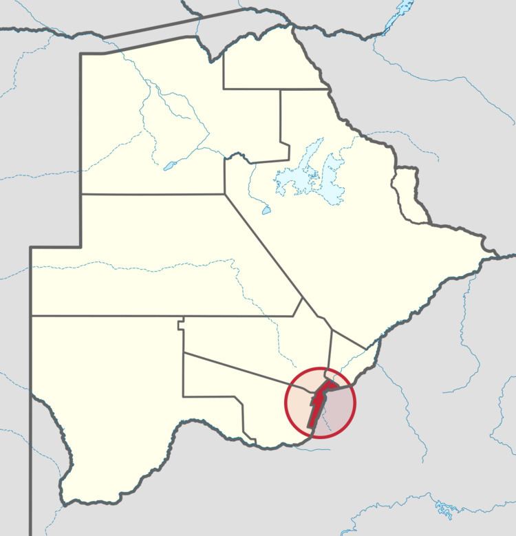
South-East is one of the districts of Botswana. The capital city of Botswana, Gaborone, is surrounded by this district. The administrative capital for the South-East district is the village of Ramotswa. In the southeast, South-East borders the North West Province of South Africa. Domestically, it borders Kgatleng in northeast, Kweneng in northwest, Southern in southwest.
Contents
- Map of South East District Botswana
- Geography
- Demographics
- Education and economy
- Administration
- References
Map of South-East District, Botswana
As of 2011, the total population of the district was 85,014 compared to 60,623 in 2001. The growth rate of population during the decade was 3.44. The total number of workers constituted 21,810 with 11,927 males and 9,883 females, with a majority of them involved in agriculture. The district is administered by a district administration and district council which are responsible for local administration. Mokolodi Nature Reserve, Gaborone Game Reserve and Manyelanong Game Reserve are the major tourist places in the district.
Geography
In the southeast, South-East borders the North West Province of South Africa. Domestically, it borders Kgatleng in northeast, Kweneng in northwest, Southern in southwest. Most part of Botswana has tableland slopes sliding from east to west. The region has an average elevation of around 915 m (3,002 ft) above the mean sea level. The vegetation type is Savannah, with tall grasses, bushes and tress. The annual precipitation is around 65 cm (26 in), most of which is received during the summer season from November to May. Most of the rivers in the region are seasonal, with Limpopo River, which are prone to flash floods, being the most prominent. Mokolodi Nature Reserve, Gaborone Game Reserve and Manyelanong Game Reserve are the major tourist places in the district.
Demographics
As of 2011, the total population of the district was 85,014 compared to 60,623 in 2001. The growth rate of population during the decade was 3.44. The population in the district was 4.20 per cent of the total population in the country. The sex ratio stood at 91.83 for every 100 males, compared to 92.49 in 2001. The average house hold size was 2.51 in 2011 compared to 4.05 in 2001. There were 4,309 craft and related workers, 2,505 clerks, 5,115 people working in elementary occupation 884 Legislators, Administrators & managers 1,650 Plant & machine operators and assemblers, 1,215 professionals, 2,438 service workers, shop & market sales workers, 464 skilled agricultural & related workers 1,708 technicians and assocaited professionals, making the total work force to 20,481.
Education and economy
As of 2011, there were a total of 67 schools in the district, with 31.70 per cent private schools. The total number of students in the Council schools was 28,479, while it was 8,383 in private schools. The total number of students enrolled in the district was 36,862: 18,387 girls and 18,475 boys. The total number of qualified teachers was 1,603, 1,303 female and 300 male. There were around 4 temporary teachers, 1 male and 5 female. There were 13 untrained teachers in the district.
As of 2006, 4,819 were involved in agriculture, 1,091 in construction, 3,182 in education, 304 in electricity and water, 356 in finance, 446 in health, 470 in hotels and restaurants, 2,674 in manufacturing, 164 in mining and quarrying, 567 in other community services, 461 in private households, 1,922 in public administration, 1,501 in real estate, 992 in transport and communications, 2,861 in wholesale and retail trade. The total number of workers was 21,810, 11,927 male and 9,883 female.
Administration
Botswana gained independence from the British in 1966 and adapted the colonial administration framework to form its district administration. The policies were modified during 1970-74 to address some of the basic issues. The district is administered by a district administration and district council which are responsible for local administration. The policies for the administration are framed by the Ministry of Local Government. The major activities of the council are Tribal Administration, Remote Area Development and Local Governance. The executive powers of the council are vested on a commissioner appointed by the central government. Technical services wing of the Department of Local Government is responsible for developing roads, infrastructure in villages like water supply, schools and recreational facilities. All the staff of the local administration expect District Administration are selected via Unified Local Government Services (ULGS) and the Ministry of Local Government is responsible for their training, deployment and career development.
The sub-districts of South-East District created as a part of National Development Park of the district are Ramotswa and Tlokweng.
In the 2011 Census the following villages were listed under each sub-district: