
Length 5.411 km | Counties: Oglala Lakota | |
 | ||
County | ||
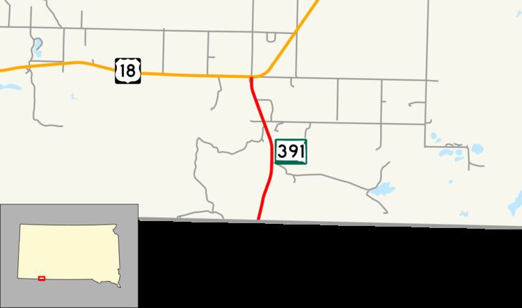
South Dakota Highway 391 (SD 391) is a state highway in the U.S. state of South Dakota. It runs from Nebraska Highway 27 (N-27) at the Nebraska state line to U.S. Route 18 (US 18) east of Denby. The whole highway is located in Oglala Lakota County and in the Pine Ridge Indian Reservation. It is maintained by the South Dakota Department of Transportation (SDDOT), and is not part of the National Highway System.
Contents
Map of SD-391, Batesland, SD 57716, USA
Route description
SD 391 begins at the Nebraska state line as a continuation of N-27 and travels northeast through rolling plains on the Pine Ridge Indian Reservation in Oglala Lakota County. The highway curves to the northwest, then bends to the north near its northern terminus. Shortly after this, the route ends at an intersection with US 18.
SD 391 is maintained by SDDOT. In 2012, the traffic on the highway was measured in average annual daily traffic, and SD 391 had an average of 920 vehicles. The designation is not a part of the National Highway System, a system of highways important to the nation's defense, economy, and mobility.