
OS grid reference TQ325633 | Dialling code 020 | |
 | ||
Population 15,790 (South Croydon ward) | ||
The treehouse south croydon
South Croydon in south London is the area surrounding the valley south of central Croydon about 1 km in radius, centred on the Red Deer public house (now a supermarket) on the Brighton Road. It is part of the South Croydon (CR2) post town and in the London Borough of Croydon. It is essentially a dormitory suburb for Croydon and London.
Contents
- The treehouse south croydon
- Map of South Croydon UK
- Toponymy
- Geography
- Nearest places
- Nearest railway stations
- References
Map of South Croydon, UK
Toponymy
The placename Croydon is recorded as early as 809 and is listed in the 1086 Domesday Book. South Croydon as a distinct area is found much later, in the 19th century, when the area was developed as a residential suburb.
Geography
The area could be considered to be bounded to the north and east by the South Croydon (CR2) postal boundary and to the west and south by the historic Croydon parish boundary, which runs from Conduit Lane to Croham Hurst, crossing Croham Road where it becomes Croham Valley Road, then across to the railway line, crossing Selsdon Road where it becomes Upper Selsdon Road and Carlton Road where it becomes Mayfield Road. Thereafter the old parish boundary roughly follows the railway south.
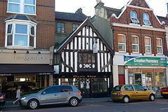
Landmarks of South Croydon include:
Green space is provided to the west by the enormous Purley Way Playing Fields, and the hidden green space with gardens that is Haling Grove sandwiched between Pampisford Road and the A23: the extensive Whitgift School playing fields frequently host international cricket and rugby matches.
The postal district of South Croydon includes Sanderstead, Selsdon and two remnants of Addington, Croham Valley and Monks Hill. It has the following schools: Haling Manor High School, Regina Coeli Catholic Primary School, St Peter's Primary School, St Giles School (specialist disabled school), Ridgeway Primary School, Gresham Primary School, Purley Oaks Primary School, Howard Primary School, Atwood Primary School, Selsdon Primary and Nursery School, Greenvale Primary School, Gilbert Scott Primary School, Whitgift School and The Quest Academy.