
Population 516 (2011) Civil parish South Creake Area 20.18 km² | OS grid reference TF861355 Sovereign state United Kingdom Local time Monday 11:26 PM | |
 | ||
Weather 4°C, Wind SE at 8 km/h, 95% Humidity District | ||
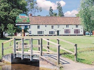
South Creake is a village and civil parish in north west Norfolk, England. The village lies 1 1⁄2 miles (2.4 km) south of its twin village of North Creake, and some five miles (8 km) north-west of the town of Fakenham.
Map of South Creake, UK
South Creake lies on the River Burn, which flows through the centre of the village. On a hill above the village can be found the Bloodgate Hill Iron Age Fort.
The civil parish has an area of 20.18 square kilometres (7.79 sq mi) and in the 2001 census had a population of 536 in 245 households, reducing to a population of 516 at the 2011 census. > For the purposes of local government, the parish falls within the district of King's Lynn and West Norfolk.
Notable people from South Creake include DJ and Producer Creake & Vibez.
References
South Creake Wikipedia(Text) CC BY-SA