
Country United States County Nowata Area code(s) 539/918 Elevation 221 m Zip code 74072 Local time Monday 5:16 PM | Time zone Central (CST) (UTC-6) FIPS code 40-68600 Area 160 ha Population 776 (2013) | |
 | ||
Weather 14°C, Wind N at 13 km/h, 71% Humidity | ||
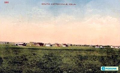
South Coffeyville is a town in Nowata County, Oklahoma, United States. As of the 2010 census, the town population was 785. The city of Coffeyville, Kansas is located approximately 1 mile north of the city, existing as a separate political entity.
Contents
Map of South Coffeyville, OK 74072, USA
History
For millennia, the land now known as Oklahoma was inhabited by Native Americans. In the 17th century, white trappers first visiting the area found it occupied mostly by the Osage and Quawpaw tribes. In 1803, modern Oklahoma was secured by the United States as part of the Louisiana Purchase. In 1819, the Arkansas Territory was organized, then was split in 1824 and 1828. An 1828 treaty with the Cherokee Nation assigned the area of Nowata County to the Cherokees, who included it in 1856 in their newly created Cooweescoowee District. The Cherokees and the Delaware signed a treaty in 1867. In 1890, the area became part of the Oklahoma Territory. In 1907, Oklahoma became the 46th U.S. state and Nowata County was founded.
In 1888, the first settlement in the area was established as Stevens, a railhead tent and shack village, built just southwest of present South Coffeyville. It was named after a Missouri, Kansas and Texas Railway builder, Stevens could be found on railroad maps until about 1902 but was eventually abandoned.
In 1906, a settlement called Polson was built approximately one mile northeast near the Missouri, Kansas and Texas Railway and Missouri Pacific Railways. Now part of the Union Pacific railway, the Missouri Pacific Railway had reached the present South Coffeyville townsite in 1889. The settlement was named after Martin and Earl Polson, early settlers, that designation was also short lived.
On March 18, 1909, a post office was established and the settlement was renamed to Etchen, in honor of a local citizen named John P. Etchen.
On April 29, 1909, the settlement was renamed a final time to the current South Coffeyville and the South Coffeyville Times newspaper began publication soon after. In August 1909, residents voted for incorporation. The name of South Coffeyville was derived from nearby city of Coffeyville, Kansas, which was named after James A. Coffey.
Geography
South Coffeyville is located at 36°59′39″N 95°37′16″W (36.994064, -95.621042). According to the United States Census Bureau, the town has a total area of 0.6 square miles (1.6 km²), all of it land.
Demographics
As of the census of 2000, there were 790 people, 329 households, and 228 families residing in the town. The population density was 1,284.7 people per square mile (500.0/km²). There were 365 housing units at an average density of 593.6 per square mile (231.0/km²). The racial makeup of the town was 84.81% White, 0.13% African American, 9.62% Native American, 0.25% Asian, and 5.19% from two or more races. Hispanic or Latino of any race were 1.90% of the population.
There were 329 households out of which 33.4% had children under the age of 18 living with them, 54.7% were married couples living together, 10.9% had a female householder with no husband present, and 30.4% were non-families. 28.6% of all households were made up of individuals and 15.5% had someone living alone who was 65 years of age or older. The average household size was 2.40 and the average family size was 2.90.
In the town, the population was spread out with 26.6% under the age of 18, 7.0% from 18 to 24, 27.7% from 25 to 44, 21.5% from 45 to 64, and 17.2% who were 65 years of age or older. The median age was 37 years. For every 100 females there were 85.4 males. For every 100 females age 18 and over, there were 86.5 males.
The median income for a household in the town was $29,688, and the median income for a family was $37,109. Males had a median income of $29,107 versus $20,179 for females. The per capita income for the town was $16,560. About 8.7% of families and 12.5% of the population were below the poverty line, including 19.4% of those under age 18 and 13.5% of those age 65 or over.
Economy
In the town, there are two convenience stores, three hair salons, one thrift store, one bar, one barber shop. There are two transmission shops, a bank, a chiropractor, a rural medical clinic, City Library, a Salvage yard, a Lumber Yard, a Furniture restoration and Cabinet Maker. The South Coffeyville Stockyards are an important business in the community. There are four churches in the community. The town also has its own Police Department and Volunteer Fire Department.