
Existed: 1922 – present Length 192.8 km | North end: SC 150 in Gaffney Constructed 1922 | |
 | ||
Tourist
routes: Cherokee Foothills Scenic Highway South end: I-85 outside of Fair Play Counties Oconee County, South Carolina | ||
The Cherokee Foothills Scenic Highway (SC 11) winds its way through Upstate South Carolina. Following the southernmost peaks of the Blue Ridge Mountains, the route is surrounded with peach orchards, quaint villages, and parks. It is an alternative to Interstate 85 and has been featured by such publications as National Geographic, Rand McNally and Southern Living.
Contents
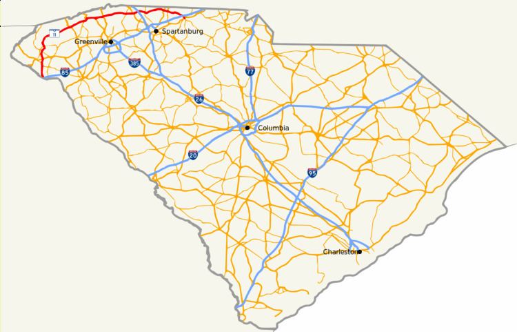
Map of SC-11, South Carolina, USA
Route description
Highway 11 begins as an intersection off Interstate 85 in southern Oconee County, 0.6 mi (1 km) from the South Carolina and Georgia border near the South Carolina Welcome Center.
History
The current highway was once part of the "Cherokee Path" or "Keowee Path," this road was the route used by the Cherokee Indians and the English and French fur traders and stretched from Tennessee to Charleston, South Carolina. This National Scenic Byway winds its way through The Upstate and passes through some towns, such as Walhalla, Marietta, Campobello, Chesnee, and Gaffney. Echoes of the area's Cherokee heritage can still be heard in places and river names like Seneca, Savannah, Keowee, Jocassee, Enoree, Toxaway, Tugaloo, Tokena, and Eastatoee.
In the city of Gaffney, east of I-85, SC 11 is known as "Floyd Baker Boulevard," which is a well-known street name in The Upstate. This section of SC 11 is a vast contrast to the rest of the route. At this point the highway becomes heavily congested and developed. Gaffney is also the biggest town along the route.