
Country United Kingdom | ||
 | ||
Similar North Calder Water, Rotten Calder, Millennium Bridge - Glasgow, Polmadie Bridge, Rutherglen Bridge | ||
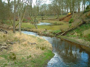
The South Calder Water,known locally as "The Cawder", is a river in Scotland. It runs west from the high plateau between Shotts and Fauldhouse to the River Clyde.
Contents
Map of South Calder Water, United Kingdom
The high plateau is also the watershed of the River Almond, which flows east into the River Forth.
Course
The South Calder Water follows a short course of approximately 10 miles, during which it winds round Shotts, Wishaw and Motherwell before flowing into the Strathclyde Loch.
Between its source and Newmains it follows a wide glacial valley and passes the village of Bonkle and Murdostoun Castle, but after Newmains ...until its end at Strathclyde Loch in Motherwell, it cuts through a very deep and meandering valley. This valley was filled in at Ravenscraig during the construction of Ravenscraig steelworks to provide a large flat area. The river is therefore placed in a "cut and cover" tunnel as it passes for approximately 1/2 mile underneath the site, before reappearing at Jerviston. Driving across the now derelict Ravenscraig site gives no clues as to the underground river flowing below.
The river ends at Strathclyde Loch, where it used to join directly with the River Clyde. The River Clyde was diverted about 1 mile west of this point in the 1960s to create the large man made loch, which is now fed purely by water from the South Calder Water.