
Population 590 (2011 census) Postal code 4670 | Postcode(s) 4670 South Bingera Elliott | |
 | ||
Location 16 km (10 mi) from Bundaberg | ||
South Bingera is a locality in the Bundaberg Region, Queensland, Australia. It is 16 kilometres (9.9 mi) south-west of Bundaberg on the Isis Highway. At the 2011 census, South Bingera had a population of 590 people.
Contents
Map of South Bingera QLD 4670, Australia
History
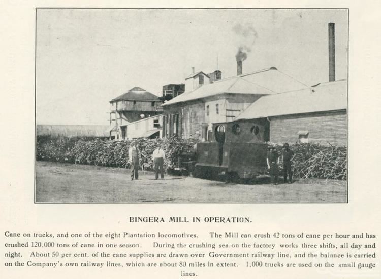
The name Bingera is believed to be derived from the Kabi language word meaning bony bream (a fish).
The Bingera Provisional School opened on 6 March 1893. In 1909 it became Bingera State School. In 1911, it was renamed Bingera South State School. The school closed about 1 December 1965.
The Bingera Railway Station Provisional School opened in 1907, becoming a State School in 1909. It closed in 1963.
Education
The Shalom Catholic College based in West Bundaberg has a 85 hectares (210 acres) site at South Bingera, used for outdoor activities and environmental education.