Highest elevation 2,119 m (6,952 ft) Population 8,482 (2014) | Founded See text Elevation 921 m Local time Monday 12:26 PM | |
 | ||
Comarca Cuenca Alta del Manzanares Weather 7°C, Wind SW at 18 km/h, 93% Humidity | ||
Soto del Real, whose former name was Chozas de la Sierra, is a town and municipality in the northern area of the autonomous Community of Madrid which had 8,294 inhabitants in 2009.
Contents
Map of 28791 Soto del Real, Madrid, Spain
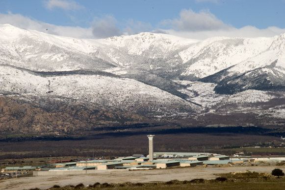
43 kilometers away from Madrid, the capital city, it is located between the towns of Manzanares el Real and Miraflores de la Sierra, and close to the Santillana reservoir.
History
The first evidence of settlements in Soto del Real dates from the 10th century, with archeological remains of houses and ceramics attributed to shepherds.
During the 13th century the area encompasing Colmenar Viejo, Chozas de la Sierra and Porquerizas (Miraflores de la Sierra) was a source of legal conflict between the provinces of Madrid and Segovia, with John I of Castile incorporating Chozas to the municipality of El Real de Manzanres in 1389.
In 1568 Philip II of Spain exempted Chozas from El Real de Manzanares.
The name Soto del Real has been in use since a 1959 vote in which the local population chose the name over Alameda de la Sierra or its historic one, Chozas de la Sierra. The town's coat of arms makes reference to both of the town's names.
Soto makes reference to the numerous trees and forests surrounding (in Spanish Sotos), del Real referring to its historical ties to El Real de Manzanares from 1389 till 1568.
Festivities
The first weekend of August Soto del Real celebrates its festivities in honour of the Virgen del Rosario (Our Lady of the Rosary), patron of the municipality.
The 7th of October, day of the Virgin of the Rosary, is also celebrated, as is the 15th of May, day of San Isidro
