
Topo map NTS 82K/10 Easiest route 5.6, long First ascent 1940 | Elevation 3,084 m Prominence 284 m | |
 | ||
Parent ranges Purcell Mountains, Regional District of East Kootenay Similar Bugaboo Spire, Pigeon Spire, Eastpost Spire, Mount Farnham, Mount Sir Donald | ||
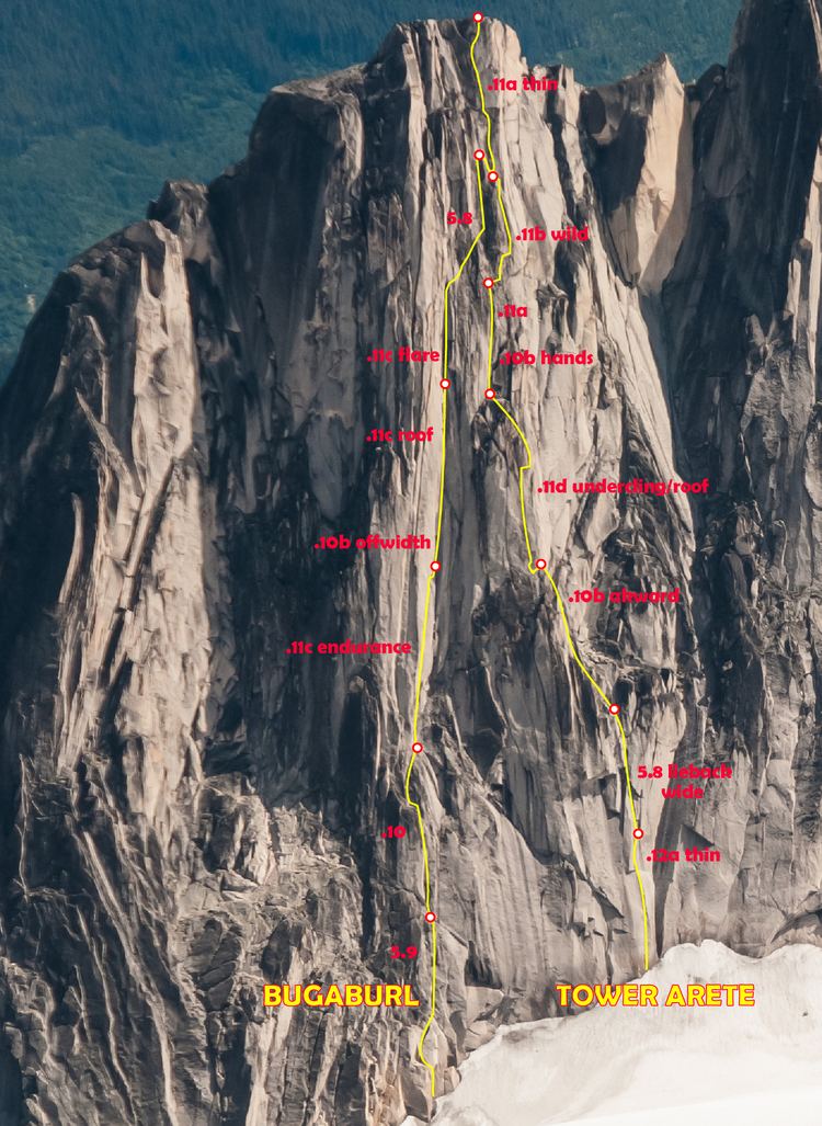
With its first ascent in 1940, Snowpatch Spire mountain peak was the last of the Bugaboo Spires to be climbed. It is located South-West of the Conrad Kain hut, across the Crescent Glacier.
Contents
Map of Snowpatch Spire, Columbia-Shuswap A, BC, Canada
Routes
Nearby
References
Snowpatch Spire Wikipedia(Text) CC BY-SA