
Max. width 5 kilometres (3.1 mi) Max. depth 121 metres (397 ft) Area 122 km² Width 5 km | Max. length 40 kilometres (25 mi) Surface area 122 km (47 sq mi) Surface elevation 24 m Length 40 km Shore length 152.3 km | |
 | ||
Reference Norwegian Water Resources and Energy Directorate | ||
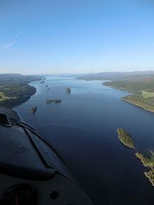
Snåsavatnet (English: Snåsa lake) is Norway's sixth-largest lake, with an area of approximately 120 square kilometres (46 sq mi). The surface is only 24 metres (79 ft) above sea level. Snåsavatnet is located in the municipalities of Steinkjer and Snåsa in Nord-Trøndelag county, Norway. The villages of Følling and Sunnan lie at the southwestern end of the lake and the village of Snåsa lies at the northeastern end of the lake. European route E6 runs along the northern shore of the lake and the Nordland Line runs along the southern shore.
Map of Sn%C3%A5savatnet, Norway
The lake is approximately 40 kilometres (25 mi) long and on average about 3 kilometres (1.9 mi) wide. The lake was created by glacial erosion. As is seen on a map, the lake looks like an extension of the Trondheimsfjord. The outlet is the river Byaelva, which empties into the Beitstadfjorden (an arm of the Trondheimsfjord) in the city of Steinkjer.