
Country United States FIPS code 54-74788 Elevation 258 m Population 164 (2013) Area code 304 | Time zone Eastern (EST) (UTC-5) GNIS feature ID 1555648 Zip code 26437 Local time Friday 2:27 PM | |
 | ||
Weather 23°C, Wind SW at 21 km/h, 42% Humidity Area 78 ha (75 ha Land / 3 ha Water) | ||
Smithfield is a town in Wetzel County, West Virginia, United States. The population was 145 at the 2010 census.
Contents
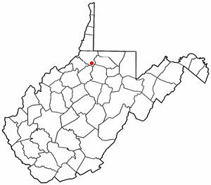
Map of Smithfield, WV, USA
Smithfield was named for Henry Smith, who kept a store there.
Geography
Smithfield is located at 39°29′49″N 80°33′40″W (39.496806, -80.561242).
According to the United States Census Bureau, the town has a total area of 0.30 square miles (0.78 km2), of which, 0.29 square miles (0.75 km2) is land and 0.01 square miles (0.03 km2) is water.
Climate
The climate in this area is characterized by hot, humid summers and generally mild to cool winters. According to the Köppen Climate Classification system, Smithfield has a humid subtropical climate, abbreviated "Cfa" on climate maps.
2010 census
As of the census of 2010, there were 145 people, 63 households, and 39 families residing in the town. The population density was 500.0 inhabitants per square mile (193.1/km2). There were 92 housing units at an average density of 317.2 per square mile (122.5/km2). The racial makeup of the town was 97.2% White, 0.7% Native American, and 2.1% from two or more races.
There were 63 households of which 31.7% had children under the age of 18 living with them, 39.7% were married couples living together, 9.5% had a female householder with no husband present, 12.7% had a male householder with no wife present, and 38.1% were non-families. 36.5% of all households were made up of individuals and 14.2% had someone living alone who was 65 years of age or older. The average household size was 2.30 and the average family size was 3.03.
The median age in the town was 44.8 years. 22.8% of residents were under the age of 18; 6.1% were between the ages of 18 and 24; 21.3% were from 25 to 44; 32.4% were from 45 to 64; and 17.2% were 65 years of age or older. The gender makeup of the town was 47.6% male and 52.4% female.
2000 census
As of the census of 2000, there were 177 people, 77 households, and 49 families residing in the town. The population density was 703.4 inhabitants per square mile (273.4/km²). There were 98 housing units at an average density of 389.5 per square mile (151.4/km²). The racial makeup of the town was 100.00% White. Hispanic or Latino of any race were 1.13% of the population.
There were 77 households out of which 23.4% had children under the age of 18 living with them, 39.0% were married couples living together, 15.6% had a female householder with no husband present, and 35.1% were non-families. 29.9% of all households were made up of individuals and 16.9% had someone living alone who was 65 years of age or older. The average household size was 2.30 and the average family size was 2.82.
In the town, the population was spread out with 19.8% under the age of 18, 11.9% from 18 to 24, 24.3% from 25 to 44, 19.8% from 45 to 64, and 24.3% who were 65 years of age or older. The median age was 42 years. For every 100 females there were 108.2 males. For every 100 females age 18 and over, there were 97.2 males.
The median income for a household in the town was $78,500, and the median income for a family was $92,188. Males had a median income of $73,125 versus $35,000 for females. The per capita income for the town was $58,279. About 1.8% of families and 2.9% of the population were below the poverty line, including 43.9% of those under the age of eighteen and 13.2% of those sixty five or over.