
Country United States of America | ||
 | ||
River mouth Confluence with the Gunnison River5,148 ft (1,569 m). | ||
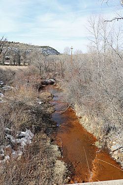
Smith Fork is a tributary of the Gunnison River that flows in Gunnison and Delta counties in western Colorado. The river is signed as "Smith Fork Creek" where it goes under Colorado State Highway 92 in Crawford, Colorado.
Map of Smith Fork, Colorado, USA
The river begins at the confluence of the North Smith Fork Gunnison River and South Smith Fork in the West Elk Mountains. Smith Fork joins the Gunnison River in the Gunnison Gorge National Conservation Area.
East of Crawford, a small dam, called the Smith Fork Diversion Dam, diverts water from Smith Fork and carries it to Crawford Reservoir via the Smith Fork Feeder Canal. The canal was built as part of the Smith Fork Project, one of the component projects of the Colorado River Storage Project.
References
Smith Fork (Colorado) Wikipedia(Text) CC BY-SA