
Country United States County Smith Area code 785 Elevation 547 m Zip code 66967 | Time zone CST (UTC−6) FIPS code 20-65925 Area 3.21 km² Population 1,610 (2013) | |
 | ||
Weather 10°C, Wind NE at 37 km/h, 78% Humidity | ||
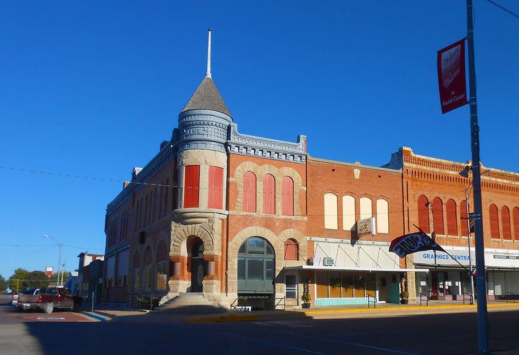
Smith Center is a city in and the county seat of Smith County, Kansas, United States. As of the 2010 census, the city population was 1,665.
Contents
- Map of Smith Center KS 66967 USA
- History
- Geography
- 2010 census
- 2000 census
- Government
- Primary and secondary education
- In popular culture
- Notable people
- References
Map of Smith Center, KS 66967, USA
History
Smith Center was founded in 1871. The first post office in Smith Center was established in January 1873. Like Smith County, Smith Center was named for Maj. J. Nelson Smith, a casualty of the Civil War.
Geography
Smith Center is located at 39°46′43″N 98°47′7″W (39.778550, -98.785141). According to the United States Census Bureau, the city has a total area of 1.24 square miles (3.21 km2), all land.
Smith Center is located at the junction of U.S. Routes 281 and 36, approximately 100 miles south of Grand Island, Nebraska and 77 miles north of Russell and Interstate 70.
2010 census
As of the census of 2010, there were 1,665 people, 779 households, and 470 families residing in the city. The population density was 1,342.7 inhabitants per square mile (518.4/km2). There were 928 housing units at an average density of 748.4 per square mile (289.0/km2). The racial makeup of the city was 97.7% White, 0.1% African American, 0.4% Native American, 0.1% Asian, 0.2% Pacific Islander, 0.4% from other races, and 1.1% from two or more races. Hispanic or Latino of any race were 1.0% of the population.
There were 779 households of which 23.2% had children under the age of 18 living with them, 49.8% were married couples living together, 7.1% had a female householder with no husband present, 3.5% had a male householder with no wife present, and 39.7% were non-families. 36.8% of all households were made up of individuals and 21.1% had someone living alone who was 65 years of age or older. The average household size was 2.10 and the average family size was 2.71.
The median age in the city was 48.7 years. 20.6% of residents were under the age of 18; 5.4% were between the ages of 18 and 24; 18% were from 25 to 44; 26.8% were from 45 to 64; and 28.9% were 65 years of age or older. The gender makeup of the city was 47.2% male and 52.8% female.
2000 census
As of the census of 2000, there were 1,931 people, 852 households, and 534 families residing in the city. The population density was 1,659.9 people per square mile (642.7/km²). There were 987 housing units at an average density of 848.4 per square mile (328.5/km²). The racial makeup of the city was 99.17% White, 0.21% Native American, 0.26% Pacific Islander, 0.10% from other races, and 0.26% from two or more races. Hispanic or Latino of any race were 0.47% of the population.
There were 852 households out of which 24.2% had children under the age of 18 living with them, 54.0% were married couples living together, 6.1% had a female householder with no husband present, and 37.3% were non-families. 34.4% of all households were made up of individuals and 21.9% had someone living alone who was 65 years of age or older. The average household size was 2.17 and the average family size was 2.77.
In the city, the age distribution of the population shows 21.0% under the age of 18, 4.7% from 18 to 24, 21.7% from 25 to 44, 20.5% from 45 to 64, and 32.1% who were 65 years of age or older. The median age was 47 years. For every 100 females there were 84.3 males. For every 100 females age 18 and over, there were 79.2 males.
The median income for a household in the city was $26,857, and the median income for a family was $36,316. Males had a median income of $25,833 versus $20,667 for females. The per capita income for the city was $15,500. About 8.7% of families and 10.7% of the population were below the poverty line, including 14.0% of those under age 18 and 12.5% of those age 65 or over.
Government
The Smith Center government consists of a mayor and five council members. The council meets the second and fourth Thursdays of each month at 7 p.m.
Primary and secondary education
Smith Center is part of Unified School District 237. The district has two schools in Smith Center:
In popular culture
In the movie The Soldier, a renegade group of KGB agents has placed a nuclear weapon in Saudi Arabia which will contaminate 1/2 of the world's oil supply, unless Israel removes its settlements from the West Bank. A rogue U.S. agent has a team take over a military base located in Smith Center, and obtains independent launch capability of a nuclear weapon located on the base to force the KGB agents to back down, or he will use it to retaliate against Moscow.