
Width 1.7 km (1.06 mi) Population (?) Area 2.68 km² | Length 2.8 km (1.74 mi) Highest elevation 103 m (338 ft) Elevation 103 m | |
 | ||
Similar Bream Head, Mount Paku, Hot Water Beach, Manganui, Te Whanganui‑A‑Hei (Cathedr | ||
Survival camp slipper island outdoor education katikati college
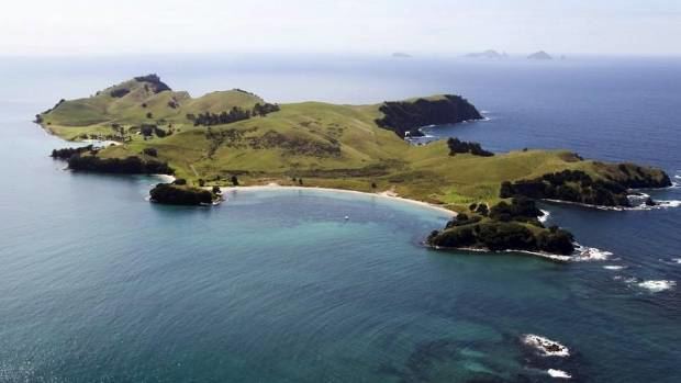
Slipper Island (Māori: Whakahau) is located 3 kilometres (1.9 mi) to the east of the Coromandel Peninsula in New Zealand's North Island and 8 kilometres (5 mi) southeast of the town of Pauanui. It is a beach resort privately owned by Nora & Abe Needham's 14 children, making it one of the few privately owned islands in New Zealand. The beach resort is 662 acres (268 ha) and guests and tourists use the only habitation on the island, the resort and the family homestead.
Contents
- Survival camp slipper island outdoor education katikati college
- Map of Slipper Island Slipper Island Whakahau New Zealand
- References
Map of Slipper Island, Slipper Island (Whakahau), New Zealand
Several smaller islets (including Penguin Island and Rabbit Island) are found off its southern tip.
References
Slipper Island Wikipedia(Text) CC BY-SA