
 | ||
Similar Sand Flats Recreation Area, Dead Horse Point Stat, Klondike Bluffs, Canyonlands National Park, Arches National Park | ||
Gopro hd mountain biking moab slickrock trail
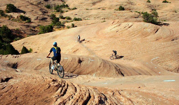
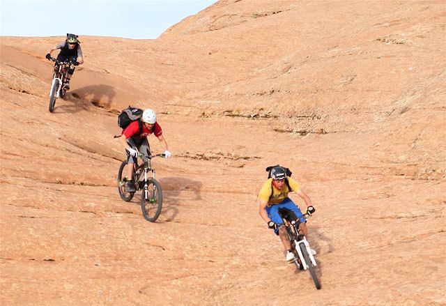
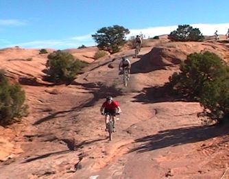
The Slickrock Trail, located near Moab, Utah (U.S.A.), is a popular mountain biking destination with worldwide fame. This 13-mile (20.9 km) loop takes intrepid riders over a landscape of "petrified" sand dunes and the eroded remnants of ancient sea beds. The Slickrock Trail is one of the more difficult rides in the Moab area, both technically and cardiovascularly, and is not suitable for novice riders.
Contents
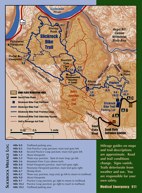
Part of the Sand Flats Recreation Area, the Slickrock Trail was originally laid out in 1969 by Richard R. Wilson for use by Honda Trail 90s (before the mountain bike was invented), and the area is still open to such recreation today. 4X4 and off-road enthusiasts will find a challenge on the nearby Hell's Revenge Trail, which intersects the Slickrock Trail in several places.
The so-called "slickrock" sandstone, which forms the majority of the trail's surface, is not slick at all, but has a surface much like sandpaper. The rubber tires of a mountain bike or off-road motorcycle will grip readily to its surface on all but the steepest hills. The sandpaper texture is notorious for inflicting severe abrasion injuries. The name "slickrock" was given by early settlers of the area because their horses' metal shoes had difficulty gaining traction on the rock's sloping surfaces. The same is true today for cyclists who use shoes with metal cleats while riding the Slickrock Trail. Slickrock also becomes very slick when wet.
In geological terms, the Slickrock Trail is not part of the actual "slickrock" formation. Rather, most of the outcrop that forms the trail is Navajo Sandstone. More commonly, the term "slickrock" has come to mean any expanse of sandstone with a surface level enough for walking or riding.
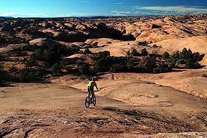
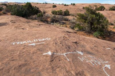
The Slickrock Trail consists of three main sections, an out-and-back lead-in (also known as a lollipop stick or a cherry stem), a 6.8-mile (10.9 km) loop, and an optional 2.3-mile (3.7 km) "practice loop". The lead-in, loop, and practice loop are clearly marked by white dashed lines to prevent riders from straying from the trail, becoming lost, or disturbing the fragile cryptobiotic soil through which the trail passes.
A minimal fee is required to enter the Sand Flats Recreation Area. Pit-toilets are available at the trailhead, but there is no drinking water available within the area.
Note: permitted trail activities included: mountain biking, hiking, motorcycling.