
 | ||
The slea head drive dingle peninsula is a magical place
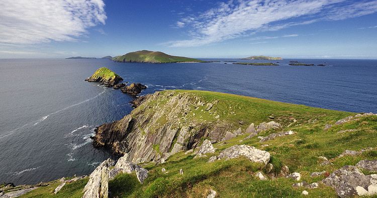
Slea Head (Irish: Ceann Sléibhe) is a promontory in the westernmost part of the Dingle Peninsula, located in the barony of Corca Dhuibhne in southwest County Kerry, Ireland. It belongs to Munster's province (County Kerry) and is served by the R559 road; the nearest villages are Ballyickeen and Coumeenoole.
Contents
- The slea head drive dingle peninsula is a magical place
- Map of Slea Head Ireland
- Explore tv ireland slea head drive to visit the blasket centre
- The Slea Head Drive
- References
Map of Slea Head, Ireland
Slea Head is together with Dunmore Head the westernmost point of Ireland and arguably is the most western point of Europe of the European mainland plinth. It is a well known and recognised landmark and also a very scenic viewpoint, with a dramatic view of the Blasket Islands. On the 11 March 1982, the Spanish container ship, Ranga, was wrecked at Dunmore Head, close to Slea Head after losing power in a storm.
Explore tv ireland slea head drive to visit the blasket centre
The Slea Head Drive
The Slea Head Drive is one of the Dingle Peninsula's most stunning routes and should be driven West to East. En route are several famous landmarks such as Ventry Beach, Pre-historic Fort and Beehive Huts, The Dingle Famine Cottage, views of the Blaskets Islands and Coumenole Beach and Gallarus Oratory. The loop road returns towards Dingle (the capital of the Kerry Gaeltacht Irish-speaking area)