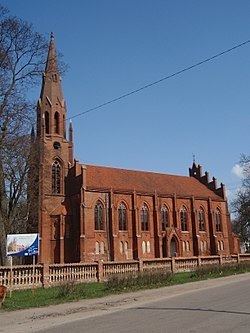
Administrative district Slavsky District Area 10 km² | Town of district significance Slavsk Local time Friday 4:06 AM | |
 | ||
Municipal district Slavsky Municipal District Weather 4°C, Wind N at 3 km/h, 81% Humidity | ||
Slavsk (Russian: Славск), prior to 1946 known by its German name Heinrichswalde (Polish: Jędrzychowo; Lithuanian: Gastos), is a town and the administrative center of Slavsky District in Kaliningrad Oblast, Russia, located 105 kilometers (65 mi) northeast of Kaliningrad, the administrative center of the oblast. Population: 4,614 (2010 Census); 5,172 (2002 Census); 4,682 (1989 Census).
Contents
- Map of Slavsk Kaliningradskaya Oblast Russia 238600
- History
- Administrative and municipal status
- Transportation
- Notable residents
- Twin towns and sister cities
- References
Map of Slavsk, Kaliningradskaya Oblast, Russia, 238600
History
The town was established in 1292. In 1819 it became seat of the Prussian Elchniederung district. After World War II and the subsequent border shift, the region was placed under Soviet administration and ethnically cleansed according to the post-war Potsdam Agreement, the native German populace was expelled.
Administrative and municipal status
Within the framework of administrative divisions, Slavsk serves as the administrative center of Slavsky District. As an administrative division, it is, together with six rural localities, incorporated within Slavsky District as the town of district significance of Slavsk. As a municipal division, the town of district significance of Slavsk is incorporated within Slavsky Municipal District as Slavskoye Urban Settlement.
Transportation
The town has a railway station on the Sovetsk-Kaliningrad railroad.
Notable residents
Twin towns and sister cities
Slavsk is twinned with:
