
Country Brazil State Pernambuco Time zone UTC-3 (UTC-3) Elevation 49 m Population 43,036 (2013) | Region Northeast Founded June 12, 1614 Postal Code 55580-000 Area 378.8 km² Local time Wednesday 9:23 PM | |
 | ||
Weather 26°C, Wind SE at 10 km/h, 91% Humidity | ||
Sirinhaém is a municipality in Pernambuco with 43,036 inhabitants. The town was founded in 1614 making it among the oldest in the state. The Prefeito is Franz Araujo Hacke of the PSD.
Contents
- Map of SirinhaC3A9m State of Pernambuco Brazil
- Access
- Geography
- Beaches
- Economy
- Economic indicators
- References
Map of Sirinha%C3%A9m, State of Pernambuco, Brazil
Access
BR-101, PE-060, PE-064 (via Cabo de Santo Agostinho)
Geography
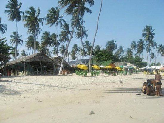
Beaches
Beach of clear water, reefs and extensive areas of coconut trees. It has some bars and Palhoças (tents) offering typical food of the region (based in fish and seafood).
Still almost virgin in its 3 kilometers long. Its part of the Gold Coast Project, created to develop in a planned and environmentally way the potential of one extensive coast area since Cabo de Santo Agostinho until Maragogi in Alagoas.
Fluvial - marine beach, is largely used to practice water sports. With six kilometers long, has several sections where bathing is not recommended, due to the violence of the waves.
Economy
The main economic activities in Sirinhaém are based in food and beverage industry, commerce, some tourism and agriculture especially coconuts.
Economic indicators
Economy by Sector, 2008