
- elevation 6,854 ft (2,089 m) Phone +1 307-332-6333 | Area 243 ha | |
 | ||
Similar Sleeping Bear RV Park & C, Lander City Park, US Forest Services Ranger S, Sinks Canyon Campgro, Maverick RV Park and Cam | ||
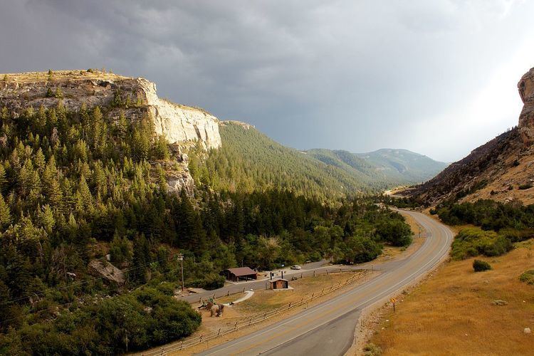
Popo agie campground trailhead sinks canyon state park wy
Sinks Canyon State Park is a publicly owned recreation area located in the Wind River Mountains, 6 miles southwest of Lander, Wyoming, on Wyoming Highway 131. The state park is named for a portion of the Middle Fork of the Popo Agie River where it flows into an underground limestone cavern, named "the Sinks," and emerges 1/4 mile down the canyon in a pool named "the Rise."
Contents
- Popo agie campground trailhead sinks canyon state park wy
- GeologyEdit
- The RiseEdit
- Plant LifeEdit
- TreesEdit
- Wild LifeEdit
- Early HistoryEdit
- Modern HistoryEdit
- Power PlantEdit
- Activities and amenitiesEdit
- Temperatures and PrecipitationEdit
- References
GeologyEdit
The Madison Limestone Formation was carved by glacial movement, leaving extensive underground fissures and steep cliff walls. The gradual recession of the ice left glacial moraines along the canyon floor. The canyon is the most southerly of the four canyons along the eastern slope of the Wind River Range.
The RiseEdit
The exact route of the passage is unknown, and dye tests have shown that the water takes over 2 hours to make its 1/4-mile underground journey. Additionally, more water flows from the Rise than enters the cavern at the Sink. The Crow Indian name of the river, "Popo Agie" (pronounced po-PO-shuh), is taken to mean "gurgling river."
Plant LifeEdit
The canyon has a wide variety of plant species which differ depending on elevation and location. Numerous types of grass, trees, shrubs and other species of plants grow throughout the canyon. The canyon's area is generally divided into two main ecological zones: a subarid environment that is mainly populated by sagebrush and a pine-fir montane forest zone.
TreesEdit
Most trees in the canyon grow on the south facing wall, and the concentration of different species depends on the different ecological zones within the canyon. The timberline in the region is roughly between 7,217 and 8,530 feet above sea level.
Common tree species:
Trees growing within the canyon can live for hundreds of years. Studies of tree rings conducted on Douglas Fir in the canyon have found trees witch started growing as early as 1649, though some of the trees were deceased at the time of sampling.
Wild LifeEdit
Wildlife is diverse and abundant in the area and can easily be observed in and around the area. A large number of birds, fish, big game and other animals call the canyon home. In all 94 species of birds have been observed within the canyon along with and including:
Early HistoryEdit
Human activity in Sinks Canyon goes back thousands of years. Archaeological digs have found hearths and tools carbon dated as far back as the last ice age.
Modern HistoryEdit
Since the late 19th Century, the canyon and its river have been utilized for a variety of purposes. Everything from a saw mill, small hydroelectric dam and power plant and ski area have been operational in the canyon.
Power PlantEdit
A hydroelectric dam and power plant were built in the canyon in the late 1910s by the Sinks Canyon Hydro Power Company and became operational by January 1920. The purpose of the plant was to supply nearby Lander with more reliable electricity. Power generation was possible most of the year except during winter months because water levels become too low. The design of the system consisted of a small stone-concrete dam standing 9 feet high and 60 feet wide built on the Popo Agie River a short distance upstream. The dam connected to the power house located at the Rise via a 3,145 foot long riveted-steel pipeline with a diameter of between 30 and 26 inches. The pipeline allowed water to flow at a rate of 17 feet per second until reaching the power house. The power house contained two 47 inch 250 horsepower hug impulse wheels, each spun by two 3 inch diameter water nozzles. The two wheels were controlled by two separate Lombard oil-pressure generators which were connected to a 150-killowatt 3 phase 60 cycle alternating-current generator operating at 2,300 volts. The power was transmitted at 11,000 volts over a copper circuit suspended by cedar poles to Lander and South Pass City as well as some oil extraction projects in the area. The plant operated until around 1954 when it was shutdown due to its age and cheaper sources of electricity becoming available.
Activities and amenitiesEdit
A visitor's center is located at the Sinks, and an observation deck overlooks the Rise. The park offers hiking trails and facilities for camping, picnicking, rock climbing, and fishing.
Temperatures and PrecipitationEdit
The climate in the canyon is consistent with the surrounding area with warm dry summers and cold winters with snow. Summers in the canyon can be hot with temperatures above 90 degrees Fahrenheit. Winters can be cold to warm depending on the side of the canyon. Most precipitation falls in spring and fall, and the snow pack accumulates mostly on the north facing side of the canyon.