
 | ||
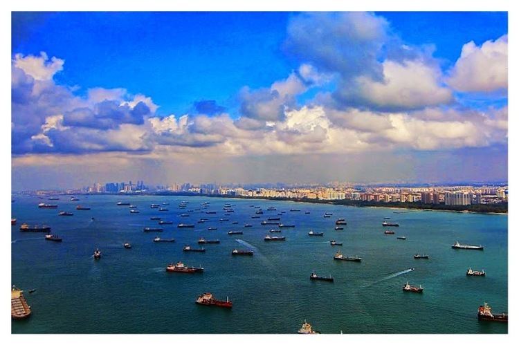
The Singapore Strait (simplified Chinese: 新加坡海峡; traditional Chinese: 新加坡海峽; pinyin: Xīnjiāpō Hǎixiá; Malay: Selat Singapura) is a 105-kilometer long, 16-kilometer wide strait between the Strait of Malacca in the west and the Karimata Strait in the east. Singapore is on the north of the channel and the Riau Islands are on the south. The Indonesia-Singapore border lies along the length of the straits.
Contents
- Map of Singapore Strait
- Historical Records
- Second World War
- Accidents
- Extent
- Pilot guides and charts
- References
Map of Singapore Strait
It includes Keppel Harbour and many small islands. The strait provides the deepwater passage to the Port of Singapore, which makes it very busy.
The depth of the Singapore Strait defines the maximum draft of vessels going through the Straits of Malacca, and the Malaccamax ship class.
Historical Records
The 9th century AD Muslim author Ya'qubi referred a Bahr Salahit or Sea of Salahit (from the Malay selat meaning strait), one of the Seven Seas to be traversed to reach China. Some have interpreted Sea of Salahit as referring to Singapore, although others considered it the Malacca Strait, especially its narrow part. Among early Europeans travellers to South East Asia, the Strait of Singapore may refer to the southern portion of the Strait of Malacca as well as other stretches of water.
Second World War
It was mined during the Second World War.
Accidents
In 2009 the Maersk Kendal grounded on the Monggok Sebarok reef.
Extent
The International Hydrographic Organization defines the limits of the Singapore Strait as follows:
On the West. The Eastern limit of Malacca Strait [A line joining Tanjong Piai (Bulus), the Southern extremity of the Malay Peninsula (1°16′N 103°31′E) and The Brothers (1°11.5′N 103°21′E) and thence to Klein Karimoen (1°10′N 103°23.5′E)].
On the East. A line joining Tanjong Datok, the Southeast point of Johore (1°22′N 104°17′E) through Horsburgh Reef to Pulo Koko, the Northeastern extreme of Bintan Island (1°13.5′N 104°35′E).
On the North. The Southern shore of Singapore Island, Johore Shoal and the Southeastern coast of the Malay Peninsula.
On the South. A line joining Klein Karimoen to Pulo Pemping Besar (1°06.5′N 103°47.5′E) thence along the Northern coasts of Batam and Bintan Islands to Pulo Koko.
Pilot guides and charts
Pilot guides and charts of the Malacca and Singapore straits have been published for a considerable time due to the nature of the straits