
- elevation 963 ft (294 m) Basin area 140.9 km² | - elevation 157 ft (48 m) | |
 | ||
Similar Silver Falls State Park, Middle North Falls, Silver Creek Reservoir, Double Falls, Oregon Garden | ||
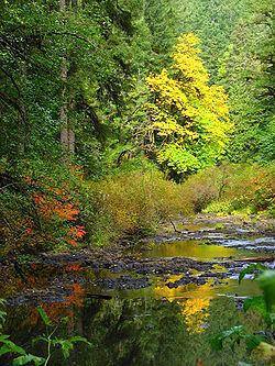
Silver Creek is a stream, about 16 miles (26 km) long, in Marion County, Oregon, United States. It is a tributary of the Pudding River and originates in Silver Falls State Park in the Cascade foothills above the cities Silverton and Stayton.
CourseEdit
Silver Creek originates in the northwestern part of Silver Falls State Park at the confluence of its North and South Forks. From there the stream flows 9.5 miles (15.3 km) north-northwest through Silver Creek Canyon and into the Silverton Reservoir. It continues out of the canyon from that point for 2.5 miles (4.0 km) and through the city of Silverton, running parallel to Oregon State Highway 214 until it veers due west at North Water Street in Silverton. It runs for another 3.2 miles (5.1 km) to its confluence at the Pudding River to the west of Silverton.