
- elevation 953 ft (290 m) Length 99.8 km Basin area 1,368 km² | - elevation 62 ft (19 m) Discharge 35.03 m³/s Basin area 1,368 km² | |
 | ||
- average 1,237 cu ft/s (35.0 m/s) - max 43,700 cu ft/s (1,237.4 m/s) | ||
The Pudding River is a 62-mile (100 km) tributary of the Molalla River in the U.S. state of Oregon. Its drainage basin covers 528 square miles (1,368 km2). Among its tributaries are Silver Creek, Butte Creek, Abiqua Creek, and the Little Pudding River.
Contents
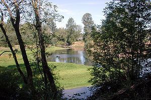
Map of Pudding River, Oregon, USA
Historically, the Pudding River flowed directly into the Willamette River, and aerial photos dating back to 1936 provide evidence of the Willamette River's confluence with the Pudding River main stem channel. Currently, it flows directly into the Molalla River near River Mile 1 before joining the Willamette River. Anadromous and resident salmonids use the Lower Pudding River main stem and key tributaries that support the basin's ecosystems.
GeologyEdit
About 24 million years ago at the end of the Oligocene, Oregon had started to look how it is today and the Willamette Bay finally became the Willamette Valley by drying up and being raised above sea level, after assuming a shape much like today's Puget Sound.
CourseEdit
The Pudding River Basin's complex of headwater creeks originates from the western edge of the Cascade Mountains along a snowpack-limited rigdeline (i.e. no glaciers are present) that forms a critical linkage from the Mount Hood National Forest and Table Rock Wilderness to Silver Falls State Park and the rolling Waldo Hills east of Salem. Peak ridgeline elevations vary from 3,750 to 4,250 feet (1,140 to 1,300 m). After emerging from the Cascade Mountain foothills of the Panther Rock Ridge and its unique forested upper-elevation wetlands and lakes, the key tributaries of the watershed like ecologically-important Butte Creek converge near Woodburn into the meandering Pudding River. Passing through and within the Pudding River Valley, the numerous subwatersheds of the Pudding Basin represent a vital part of fertile agricultural lands of the Lower Willamette Valley sub-basin. Two forks of the Pudding join between the cities of Silverton and Mt. Angel, at 45.036368°N 122.833275°W / 45.036368; -122.833275, as the river continues its course northward where it receives Abiqua Creek from the right at about 2 miles (3.2 km) northwest of Silverton. North of Mt. Angel, Butte Creek, which comes down from the Cascade Range foothills past Scotts Mills, empties into the Pudding River at 45.160768°N 122.773569°W / 45.160768; -122.773569. The river continues northward past the town of Aurora. For most of its course, Butte Creek and the Lower Pudding River mainstem defines the boundary between Marion and Clackamas Counties.
The Pudding River flows into the Molalla River, at 45.282375°N 122.716856°W / 45.282375; -122.716856, just before the Molalla joins the Willamette River in a floodplain that is part of the Molalla River State Park.
FishingEdit
The upper river offers catch-and-release fishing for wild trout, while the lower river has bass and panfish. Although the Pudding River is not stocked with hatchery fish, coastal cutthroat trout and rainbow trout enter the upper main stem from Drift, Butte, Silver, and Abiqua creeks. Fishing is restricted to artificial flies and lures and is not allowed for winter-run steelhead (anadromous rainbow trout) that spawn in the tributaries. The extreme lower reaches of the river are navigable by boat when the stream flow is sufficient, sometimes as late as June.