
Time zone Mountain (MST) (UTC-7) Elevation 1,663 m Population 2,980 (2013) Area code 970 | Incorporated May, 1915 FIPS code 08-70195 Zip code 81652 Local time Tuesday 3:36 PM | |
 | ||
Weather 22°C, Wind W at 23 km/h, 17% Humidity Area 3.781 km² (3.73 km² Land / 5 ha Water) | ||
Nude climbing sculpture in downtown silt colorado
Silt is a Statutory Town in Garfield County, Colorado, United States. The population was 2,930 at the 2010 census, up from 1,740 at the 2000 census.
Contents
- Nude climbing sculpture in downtown silt colorado
- Map of Silt CO USA
- Walking along interstate 70 near silt colorado
- Geography
- Climate
- Demographics
- References
Map of Silt, CO, USA
A post office called "Silt" has been in operation since 1898. The community was named for the silt deposits at the original town site.
Walking along interstate 70 near silt colorado
Geography
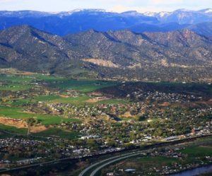
Silt is located at 39°32′47″N 107°39′7″W (39.546316, -107.652072), on the north side of the Colorado River about 175 miles (282 km) west of Denver. Interstate 70 passes through the town as it follows the river, with access from Exit 97. Glenwood Springs, the county seat, is 19 miles (31 km) to the east, and Rifle is 7 miles (11 km) to the west. U.S. Route 6 is Main Street in Silt, and provides a local route parallel to I-70.
According to the United States Census Bureau, the town has a total area of 1.5 square miles (3.8 km2), of which 0.023 square miles (0.06 km2), or 1.46%, is water.
Climate
This climatic region is typified by large seasonal temperature differences, with warm to hot (and often humid) summers and cold (sometimes severely cold) winters. According to the Köppen Climate Classification system, Silt has a humid continental climate, abbreviated "Dfb" on climate maps.
Demographics
As of the census of 2000, there were 1,740 people, 648 households, and 452 families residing in the town. The population density was 616.6 people per square mile (238.2/km²). There were 668 housing units at an average density of 236.7 per square mile (91.5/km²). The racial makeup of the town was 89.60% White, 0.17% African American, 1.32% Native American, 7.41% from other races, and 1.49% from two or more races. Hispanic or Latino of any race were 14.20% of the population.
There were 648 households out of which 41.0% had children under the age of 18 living with them, 58.3% were married couples living together, 7.1% had a female householder with no husband present, and 30.2% were non-families. 23.9% of all households were made up of individuals and 5.9% had someone living alone who was 65 years of age or older. The average household size was 2.69 and the average family size was 3.21.
In the town, the population was spread out with 30.5% under the age of 18, 7.8% from 18 to 24, 37.6% from 25 to 44, 18.2% from 45 to 64, and 5.9% who were 65 years of age or older. The median age was 31 years. For every 100 females there were 108.9 males. For every 100 females age 18 and over, there were 104.4 males.
The median income for a household in the town was $44,632, and the median income for a family was $51,736. Males had a median income of $37,566 versus $25,417 for females. The per capita income for the town was $17,723. About 5.0% of families and 7.8% of the population were below the poverty line, including 5.1% of those under age 18 and 17.1% of those age 65 or over.