
Peak Monte Oscuro | Elevation 822 m (2,697 ft) State/Province ES-AR Highest point Monte Oscuro Age of rock Cambrian | |
 | ||
Mountains Huegas, Vedao, Corona de la Reina, Sigena, Monte Oscuro, San Caprasio Similar San Caprasio, Nuestra Señora de las Fuentes, Monegros Desert, Alcanadre, Monastery of Santa María de | ||
Posicion san simon sierra de alcubierre
Sierra de Alcubierre is a 40 km (25 mi) long mountain range in the Monegros comarca, Aragon, Spain. It is located between the provinces of Zaragoza and Huesca.
Contents
- Posicion san simon sierra de alcubierre
- Map of Sierra de Alcubierre 50161 Zaragoza Spain
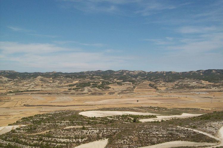
- Sierra de alcubierre nov 2016
- Geography
- References
Map of Sierra de Alcubierre, 50161, Zaragoza, Spain
Sierra de alcubierre nov 2016
Geography
This mountain chain crosses the arid eastern end of the Monegros comarca from northwest to southeast and divides the basins of the Gállego and Isuela rivers. It has numerous ravines and its landscape is characteristic of badlands.
The ridge's highest summits are Monte Oscuro (822 m) and San Caprasio (811 m); other summits are Corona de la Reina (629 m) and Vedao (548 m), located at the northern end of the range, as well as Sigena (592 m) and Huegas (447 m), located at the southern end.
This mountain range is named after the town of Alcubierre, located 3 km east of the range. The Sierra de Alcubierre is divided into subranges, foremost of which are Sierra de Lanaja, named after Lanaja town, and Sierra de Pallaruelo, named after Pallaruelo de Monegros village, both located roughly in the central part of the main range.