Topo map USGS Capulin Elevation 2,658 m Easiest route Hiking | Mountain type Shield volcano Prominence 573 m | |
 | ||
Similar Raton‑Clayton volcanic field, Capulin Volcano National, Black Mesa, Mount Taylor, Victorio Peak | ||
Los jefes de la sierra grande guatemala es mi pais autor misael bravo
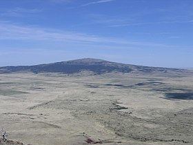
Sierra Grande is an extinct shield volcano in northeastern New Mexico that rises 2,200 feet above the surrounding plain. It is part of the inactive Raton-Clayton volcanic field.
Contents
- Los jefes de la sierra grande guatemala es mi pais autor misael bravo
- Map of Sierra Grande New Mexico 88418 USA
- Los jefes de la sierra grande mi cantar autor misael bravo
- GeographyEdit
- References
Map of Sierra Grande, New Mexico 88418, USA
Los jefes de la sierra grande mi cantar autor misael bravo
GeographyEdit
Sierra Grande is the easternmost point in the United States that reaches an elevation of more than 8,000 feet (2,400 m) above sea level.
U.S. Highway 64 and U.S. Highway 87 run along the north and east of the volcano. The town of Des Moines is just to the northeast. To the northwest is Capulin Volcano National Monument featuring Capulin Volcano, an extinct cinder cone also in the Raton-Clayton volcanic field.
References
Sierra Grande Wikipedia(Text) CC BY-SA
