
Time zone +8 Area 33.13 km² Local time Sunday 7:56 PM | Website www.shulin.ntpc.gov.tw Population 184,329 (Jan 2016) | |
 | ||
Weather 16°C, Wind E at 16 km/h, 48% Humidity Points of interest Antler Creek wetland, Wuqi Park, Yuanzhuminzhutibuluo Park, Tandi Park, Hebin Sports Park | ||
Shulin district part 3 a ride on the metro rail train mrt
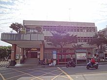
Shulin District (Chinese: 樹林區; pinyin: Shùlín Qū; Pe̍h-ōe-jī: Chhiū-nâ-chhī) is an inner city district in southwestern New Taipei City, Taiwan.
Contents
- Shulin district part 3 a ride on the metro rail train mrt
- Map of Shulin District New Taipei City Taiwan
- Name
- History
- Administrative divisions
- Transportation
- References
Map of Shulin District, New Taipei City, Taiwan
Name
The area was named Shulin by the daily business commuters after seeing the sights of abundance of woods and trees in the region.
History
Shulin was upgraded to a county-controlled city of Taipei County on 4 October 1999 from a township, and to a district of New Taipei City on 25 December 2010.
Administrative divisions
Sanxing Village, Sanfu Village, Sanduo Village, Sanlong Village, Qiangliao Village, Guangxing Village, Jinliao Village, Tande Village, Wenlin Village, Baoan Village, Zunan Village, Zunfu Village, Zunmin Village, Zunsheng Village, Shude Village, Shufu Village, Shuxi Village, Shuxing Village, Shuren Village, Yuying Village, Shunan Village, Ponei Village, Shutung Village, Shubei Village, Pengfu Village, Heping Village, Pengxing Village, Pengcuo Village, Datong Village, Zhonghua Village, Taishun Village, Tungsheng Village, Tungyang Village, Tungshan Village, Shanjia Village, Zhongshan Village, Leshan Village, Ganyuan Village, Xiyuan Village, Nanyuan Village, Tungyuan Village, Beiyuan Village.