
Country United States Incorporated 1727 Elevation 204 m Population 35,608 (2010) | Settled 1722 Time zone Eastern (UTC-5) Zip code 01545 Local time Sunday 5:33 AM | |
 | ||
Weather 0°C, Wind NW at 3 km/h, 92% Humidity | ||
Video of 19 o donnell avenue shrewsbury massachusetts real estate homes
Shrewsbury is a town in Worcester County, Massachusetts, United States. Shrewsbury, unlike other surrounding towns like Grafton, Millbury, Westborough, and Northborough did not become a mill town or farming village, rather most of its 19th-century growth was due to its proximity to Worcester and visitors to Lake Quinsigamond, making it effectively a Summer resort town. The population was 35,608 according to the 2010 US Census, in nearly 12,400 households.
Contents
- Video of 19 o donnell avenue shrewsbury massachusetts real estate homes
- Map of Shrewsbury MA USA
- History
- Registered Historic Places
- Geography
- Demographics
- Town government
- Education
- Library
- Notable people
- Notable businesses
- References
Map of Shrewsbury, MA, USA
Incorporated in 1727, the town is governed now under the New England representative town meeting system, headed by the Town Manager and five-member elected Board of Selectmen whose duties include licensing, appointing various administrative positions, and calling a town meeting of citizens annually or whenever the need arises.
History
The Town of Shrewsbury, named for Shrewsbury, England, is a suburban community with an uneven and hilly terrain cut by a number of minor streams providing several small water power sites. Grants of land were made in what would eventually be the town beginning in 1664, with the 3,200-acre (13 km2) grant called Haynes Farm as the largest. Settlers came primarily from Sudbury and Marlborough, and the first permanent settler was Gersham Wheelock in 1720. As a town, Shrewsbury was first settled in 1722 and officially incorporated in 1727.
Townspeople created an agricultural economy with apple orchards, and by 1750, there were two stores and four taverns as well as several small industries in operation. The rapid fall of prices for agricultural goods, the shortage of hard currency, and the general economic depression following the Revolutionary War produced disastrous conditions for colonists. Shays' Rebellion in 1786 sought to close the courts to prevent debt collections and the foreclosure of mortgages. Shrewsbury became a staging area for the rebellion and the encampment of the more than 400 insurgents, before the march on the Worcester Court House.
A leather industry began in 1786 in Shrewsbury, and town farmers developed large cattle herds to support the manufacture of boots and shoes. This was followed by the establishment of gunsmithing operations in 1797, which produced rifles, shotguns and pistols and eventually cutlery. Luther Goddard began in 1809 by making brass clocks and then established a small watch factory employing a few skilled Swiss and English watchmakers. Lumbering created sawmills, and they in turn drew chair and cabinet makers, plow and wagon builders.
The development of streetcar routes in the 19th century spurred the growth of single-family housing in town. A summer resort population on Lake Quinsigamond became consumers of the market garden produce grown by town farmers. As Shrewsbury's industry was killed off by the lack of large waterpower sites and the tardy arrival of the railroad, its role as a suburb of Worcester grew more important. The town's population doubled from 1915 to 1940 as continued streetcar suburb growth brought more modern settlers into the community. Other modern developments included an increased number of lakeside cottages, ethnic clubs and recreational areas on the lake. The economy of modern Shrewsbury has been described as depending on agriculture, the resort industry and the providing of recreation and food for the population of Worcester.
Registered Historic Places
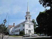
Shrewsbury is home to three current and one former Nationally Registered Historic Places:
Geography
Shrewsbury is a suburb of Worcester, about 45 minutes from Boston and 10 minutes to downtown Worcester.
The town has a total area of 21.6 square miles (56 km2), of which, 20.7 square miles (54 km2) of it is land and 0.9 square miles (2.3 km2) of it (4.25%) is water.
Demographics
By the 2010 census, the population had reached 35,608.
As of the census of 2000, there were 31,640 people, 12,366 households, and 8,693 families residing in the town. The population density was 1,526.3 inhabitants per square mile (589.3/km2). There were 12,696 housing units at an average density of 612.4 per square mile (236.4/km2). The racial makeup of the town was 89.12% White, 1.45% African American, 0.12% Native American, 7.61% Asian, 0.01% Pacific Islander, 0.69% from other races, and 1.00% from two or more races. Hispanic or Latino of any race were 1.59% of the population.
There were 12,366 households, out of which 34.5% had children under the age of 18 living with them, 60.1% were married couples living together, 7.5% had a female householder with no husband present, and 29.7% were non-families. 25.3% of all households were made up of individuals, and 10.5% had someone living alone who was 65 years of age or older. The average household size was 2.54, and the average family size was 3.09.
In the town, the population was spread out, with 25.6% under the age of 18, 5.0% from 18 to 24, 33.4% from 25 to 44, 22.4% from 45 to 64, and 13.5% who were 65 years of age or older. The median age was 38 years. For every 100 females, there were 94.6 males. For every 100 females age 18 and over, there were 91.4 males.
The median income for a household in the town was $109,000, and the median income for a family was $124,000 (as of the 2010 census)). Males had a median income of $56,259 versus $37,129 for females. The per capita income for the town was $45,570. About 3.3% of families and 4.8% of the population were below the poverty line, including 4.6% of those under age 18 and 7.6% of those age 65 or over.
Town government
Shrewsbury is governed in the traditional New England style. Municipal elections are held on the first Tuesday in May.
Legislative Branch: Representative Town Meeting: 240 elected members.
Executive Branch: Five-member Board of Selectmen with three-year staggered terms, an appointed Town Manager, and other elected and appointed positions.
Source: "Town Officials". Town of Shrewsbury.
Various other boards, committees, and commissions round out the variety of services provided to residents, including water, health, fire, ambulance, police, education, recreation, etc.
Education
Shrewsbury Public Schools is the public school district in the town. Schools in the district include Shrewsbury High School, two middle schools, four elementary schools, one early childhood school for kindergarten and grade one, and one preschool. Non-public schools in town include Shrewsbury Montessori, a private school offering programs for pre-K through grade 6; St. Mary's School, a Catholic parochial school for pre-K through grade 8; and Saint John’s High School, a private Xaverian Brothers sponsored high school.
Library
The Shrewsbury Public Library was established in 1872. In fiscal year 2008, the town of Shrewsbury spent 1.4% ($1,164,563) of its budget on its public library — about $34 per town resident. Following the 1978 library expansion project, another expansion was needed. In 2004 and 2010, officials completed research showing inadequate space, poorly maintained roofs and heating/cooling systems, lack of handicap accessibility, and a growing demand for library services. In 2010, a project was proposed that would create a new 42,000-square-foot (3,900 m2) facility for a total of approximately $19 million. The main library closed to enable construction of the new building and opened in temporary accommodation at 214 Lake Street on 26 October 2014. As of June 15, 2016, construction on the expansion project was substantially complete and work on punch list items was ongoing.
The new library celebrated its grand opening with a ribbon-cutting ceremony on September 21, 2016.