
Native name Шренк | Country Russia | |
 | ||
Main source Byrranga Mountains.
270 m (890 ft) River mouth Confluence with the Lower Taymyr River
0.6 m (2 ft 0 in) Basin size 11,800 km (4,600 sq mi) Length 372 km (231 mi) (total) Discharge Average rate:
1,220 m/s (43,000 cu ft/s) | ||
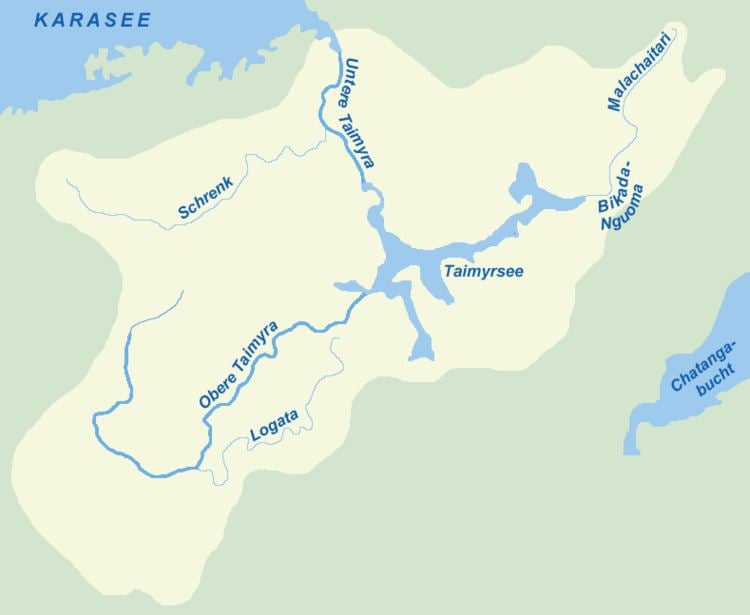
The Shrenk River (Russian: Шренк) is a 372-mile (599 km) long river in Russia, the main left tributary of the Taymyr River. It is located in the western side of the Taymyr Peninsula in the Krasnoyarsk Krai administrative region of the Russian Federation.
Contents
Map of r. Shrenk, Krasnoyarsk Krai, Russia
Course
The Shrenk flows into the Lower Taymyr after the latter flows out of Lake Taymyr northwards across the Byrranga mountain region into the Taymyr Gulf of the Kara Sea. Its length is 372 km. The Shrenk's main left hand tributary is the 168 km long Mamonta ('Mammoth River'), where the remains of the northernmost Mammoth in the world were found in 1948. Its right hand tributaries are the 74 km long Moskvichka, the 84 km long Possadochnaya, the 94 km long Gryadovaya and the 93 km long Gravijnaya.
The area of the Shrenk basin is a largely uninhabited and desolate expanse without modern infrastructures. It was explored by Russian biologist and explorer Alexander von Middendorff in 1843.