
Population 3,390 (1992) Area 590.5 km² | Established 1860 Founded 1860 | |
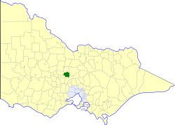 | ||
The Shire of Metcalfe was a local government area about 105 kilometres (65 mi) north-northwest of Melbourne, the state capital of Victoria, Australia, and 45 kilometres (28 mi) south of the regional city of Bendigo. The shire covered an area of 590.52 square kilometres (228.0 sq mi), and existed from 1860 until 1995.
Contents
History
Metcalfe was incorporated as a road district on 14 August 1860, and became a shire on 18 July 1865.
Metcalfe absorbed two boroughs which had previously been separately governed; On 7 October 1870, the Taradale Borough was united, while the Chewton Borough, created on 14 December 1860 with an area of 23.31 square kilometres (9.00 sq mi), was united on 2 May 1916.
On 20 January 1995, the Shire of Metcalfe was abolished, and, along with the City of Castlemaine and the Shires of Maldon and Newstead, was merged into the newly created Shire of Mount Alexander. The town of Redesdale and the area surrounding Lake Eppalock were transferred into the City of Greater Bendigo.
Wards
The Shire of Metcalfe was divided into four ridings, each of which elected three councillors:
Towns and localities
Population
* Estimate in the 1958 Victorian Year Book.