
Population 2,850 (1992) County Borung, Kara Kara Area 1,550 km² Council seat Rupanyup | Established 1877 Shire of Dunmunkle Kara Kara Founded 1877 | |
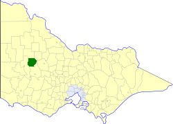 | ||
The Shire of Dunmunkle was a local government area about 160 kilometres (99 mi) west of Bendigo and 50 kilometres (31 mi) east of Horsham, in western Victoria, Australia. The shire was bounded by the Yarriambiack Creek on the western boundary and the Richardson River on the east. The shire covered an area of 1,550 square kilometres (598.5 sq mi), and existed from 1877 until 1995.
Contents
History
Dunmunkle was first incorporated as a shire on 28 September 1877. In May 1916, the shire lost part of its North Riding to the Shire of Donald, but gained parts of the South and East Ridings of the Shire of Warracknabeal.
On 20 January 1995, the Shire of Dunmunkle was abolished, and, along with parts of the Shires of Karkarooc, Warracknabeal and Wimmera, was merged into the newly created Shire of Yarriambiack. The Avon-Richardson district was transferred to the newly created Shire of Northern Grampians.
Wards
The Shire of Dunmunkle was divided into three wards, each of which elected three councillors:
Towns and localities
Population
* Estimate in the 1958 Victorian Year Book.