
Population 143,697 (1991 census) Founded 1948 | Established 1948 Area 1,224 km² | |
 | ||
The Shire of Albert was a local government area in Queensland, located south of the capital, Brisbane, and taking in areas to the north and west of the Gold Coast. It was named after the Prince Consort of the United Kingdom, and husband of Queen Victoria, Prince Albert. When created in 1948, it was primarily a rural area, but its growth started in earnest in the late 1960s with the development of Logan on Brisbane's southern frontier. After the separate creation of Logan as a shire (later City) in 1978, Albert lost most of its population and became more centred upon the Gold Coast, which experienced a massive period of growth from then until the Shire's amalgamation with the City of Gold Coast in 1995.
Contents
Divisional Boards
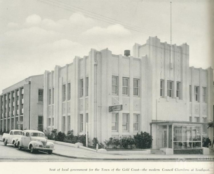
By the late 1870s, the Government of Queensland had become preoccupied with the idea of getting local residents to pay through rates for local services, which had become a massive cost to the colony and were undermaintained in many areas. The McIlwraith government initiated the Divisional Boards Act 1879 which created a system of elected divisional boards covering most of Queensland. It was assented by the Governor on 2 October 1879, and on 11 November 1879, the Governor gazetted a list of 74 divisions which would come into existence. Four of these—Nerang, Coomera, Beenleigh and Waterford—were in the Gold Coast region. Town dwellers had different needs to the rural landholders so Southport ratepayers lobbied the Queensland Government to create a separate Divisional Board so that rates monies raised by Southport landholders could be spent on town improvements. This resulted in the Southport Divisional Board on 14 July 1883.
Shires and towns
On 31 March 1903, following the enactment of the Local Authorities Act 1902, the divisions became shires. On 12 June 1914, the Coolangatta was created from part of the Shire of Nerang, and on 12 April 1918, Southport became a Town.
Amalgamations in 1948
On 9 December 1948, as part of a major reorganisation of local government in South East Queensland, an Order in Council replacing ten former local government areas between the City of Brisbane and the New South Wales border with only four. The former ten were:
The four resulting local government areas were:
The Order came into effect on 10 June 1949, when the first elections were held.
Suburban growth
The northern part of the Shire expanded rapidly from the late 1960s onwards with the development of the Logan area, which had become a southeastern suburban growth corridor for Brisbane. On 8 June 1978, the Shire of Logan was separately incorporated, and Albert lost 110.0 km2 (42.5 sq mi) of its area and 54,650 people in the change—almost three-quarters of its population. The effect of this change was to transform Albert into a purely Gold Coast-area council. With the astronomic growth levels experienced by the Gold Coast area from the late 1970s onwards, the new Albert grew from 18,753 at the 1976 census to 143,697 in 1991.
On 19 March 1992, the Electoral and Administrative Review Commission, created two years earlier, produced its report External Boundaries of Local Authorities, and recommended a number of changes to local government boundaries and the amalgamation of some local governments. Although their recommendations only included boundary adjustments between City of Gold Coast and Albert Shire, the outcome following much public debate was a decision by the Queensland Government to absorb Albert Shire into Gold Coast City. The Local Government (Albert, Beaudesert and Gold Coast) Regulation 1994 was gazetted on 16 December 1994, resulting in the amalgamation of the Shire of Albert into Gold Coast City at the 1995 local government elections.
Towns and localities
The Shire of Albert included the following settlements:
1 - not to be confused with Willowvale of the Southern Downs Region
Chairmen
The following served as chairmen of the Shire of Albert:
Population
The population of the Albert region is only offered from the 1947 census onwards. The 1949 Queensland Year Book (p. 42) notes the following populations.
The 1950 Year Book, which uses the new boundaries, gives an area of 511 sq mi (1,323 km2) and a population of 7,261 (a difference of 1,307 people) for the Shire of Albert.
Following the 1976 census, most of Albert's population were transferred to the new Logan local government area.