
Area 46.53 km² Population 7,722 (Dec 2014) | Phone number 0244-62-2111 Local time Sunday 12:38 AM | |
 | ||
Weather 2°C, Wind NW at 6 km/h, 90% Humidity | ||
Tsunami in shinchi fukushima prefecture japan
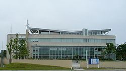
Shinchi (新地町, Shinchi-machi) is a town located in Sōma District, Fukushima Prefecture, Japan. As of December 2014, the town has an estimated population of 7,722 and a population density of 167 persons per km2. The total area is 56.35 square kilometres (21.76 sq mi).
Contents
- Tsunami in shinchi fukushima prefecture japan
- Map of Shinchi Soma District Fukushima Prefecture Japan
- Past tsunami inundation road 22 shinchi fukushima japan 4k movie
- Geography
- Surrounding municipalities
- History
- 2011 earthquake and tsunami
- Education
- Railway
- Highway
- References
Map of Shinchi, Soma District, Fukushima Prefecture, Japan
Past tsunami inundation road 22 shinchi fukushima japan 4k movie
Geography
Shinchi is located in the far northeastern corner of Fukushima Prefecture, bordering on Miyagi Prefecture to the north and the Pacific Ocean to the east.
Surrounding municipalities
History
The area of present-day Shinchi was part of Mutsu Province, and was included in the holdings of Sendai Domain under the Tokugawa shogunate of Edo period Japan. After the Meiji restoration, on April 1, 1889, the village of Shinchi was created within Uda District, Fukushima. Uda District became Sōma District in 1896. On April 20, 1954 Shinchi annexed the neighboring villages of Fukuda and Komagamine. Shinchi was elevated to town status on August 1, 1971.
2011 earthquake and tsunami
The eastern, coastal portion of Shinchi was inundated by devastating tsunami flood waters following the magnitude 9.0 2011 Tōhoku earthquake and tsunami off its coastline on March 11, 2011. The tsunami destroyed 577 houses, or approximately half the home in the town, and the final death toll was 116 residents.
Education
Shinchi has one high school, one middle school and three elementary schools.