
 | ||
Points of interest Cap Ōma, Shiriyazaki Lighthouse, Shimofuro Hot Spring, Hotoke‑ga‑ura, Kaikyōisaribi Park | ||
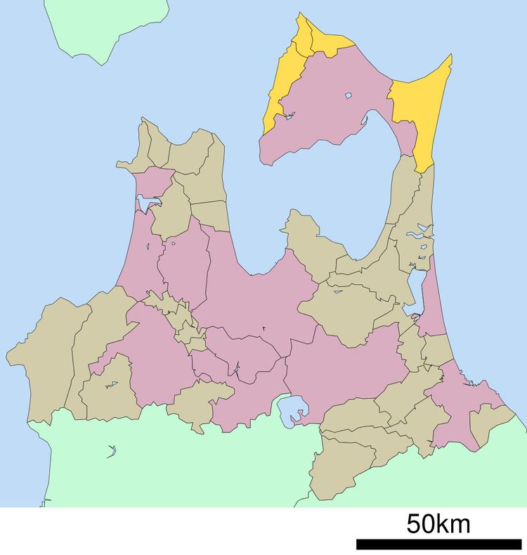
Shimokita District (下北郡, Shimokita-gun) is a district located in Aomori Prefecture, Japan. It occupies most of the northern handle of Shimokita Peninsula with the exception of Mutsu City and contains the most northern point on the island of Honshū. It is also home to the Japanese macaque, making it the northernmost natural habitat for monkeys anywhere in the world.
Contents
Map of Shimokita District, Aomori Prefecture, Japan
As of 2009, the district has an estimated population of 18,297 and a density of 33.2 persons per km². The total area was 551. 08 km².
Towns and villages
The district currently consists of one town and three villages. The city of Mutsu was formerly part of the district.
History
Shimokita District was part of ancient Kita County (北郡, Kita-gun), established by the Northern Fujiwara. During the Edo period, the area was part of the Morioka han feudal domain of the Nambu clan, with a daikansho located in Tanabu (now part of the city of Mutsu.
The Nambu clan sided with the Ōuetsu Reppan Dōmei during the Boshin War of the Meiji Restoration and were punished by the new Meiji government by loss of their northern territories. In November 1869, Kita-gun and neighboring Sannohe District became part of the newly created Tonami Domain (斗南藩, Tonami-han), a 30,000 koku holding created to resettle the dispossessed Matsudaira clan from Aizu-Wakamatsu. In July 1871, with the abolition of the han system, Tonami Domain became Tonami Prefecture, and was merged into the newly created Aomori Prefecture in September 1871.
During the early Meiji period administrative reorganization of Japan on July 22, 1878, Shimokita and Kamikita were divided from former Kita County, and Shimokita was divided into 33 villages. In the cadastral reform of April 1, 1889, the number of villages was reduced through consolidations and mergers to nine. Tanabu Village was elevated to town status on January 1, 1899 and Kawauchi Village became Kawauchi Town on October 31, 1917. On November 10, 1928 the Imperial Japanese Navy port of Ōminato was proclaimed a town, followed by Ōhata Town on May 1, 1934. Ōma Village became Ōma Town on November 3, 1942. On September 1, 1959 Ōminato and Tanabu towns merged to form the city of Ōminato-Tanabu, later renamed Mutsu. On March 14, 2005 the towns of Kawauchi and Ōhata and the village of Wakinosawa merged into the city of Mutsu.