
Post code 041-1498 Population 4,066 (28 Feb 2017) | Area code(s) 01343 Local time Saturday 9:56 PM | |
 | ||
Weather 0°C, Wind SE at 14 km/h, 79% Humidity Points of interest Shikabekanketsusen Park, Shikabe Hot Spring, Shikabe Hyotannuma Park | ||
Shikabe (鹿部町, Shikabe-chō) is a town located in Kayabe District, Oshima Subprefecture, Hokkaido, Japan.
Contents
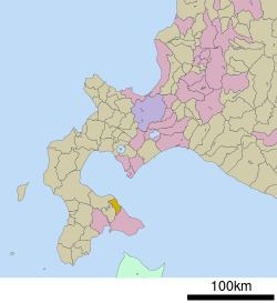
- Map of Shikabe Kayabe District Hokkaido Prefecture Japan
- Geography
- Neighboring municipalities
- Demographics
- History
- Education
- References
Map of Shikabe, Kayabe District, Hokkaido Prefecture, Japan
The town has a total area of 110.61 square kilometres (42.71 sq mi).
Geography
Shikabe is located in northeast of Oshima Peninsula. There is Hokkaido Koma-ga-take on northwest of the town.
The name of "Shikabe" is derived from Ainu word "sikerpe", meaning "Place with Phellodendron amurense".
Neighboring municipalities
Demographics
On February 28, 2017, the town had an estimated population of 4,066 and a density of 37 persons per km².
History
Education
References
Shikabe, Hokkaido Wikipedia(Text) CC BY-SA