
 | ||
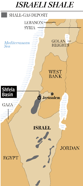
Shfela
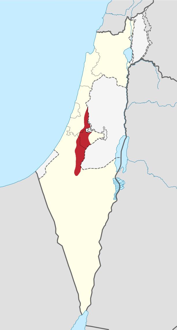
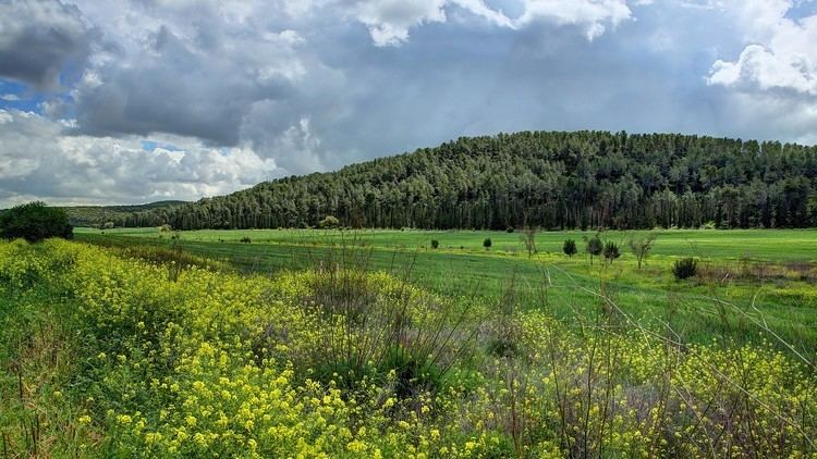
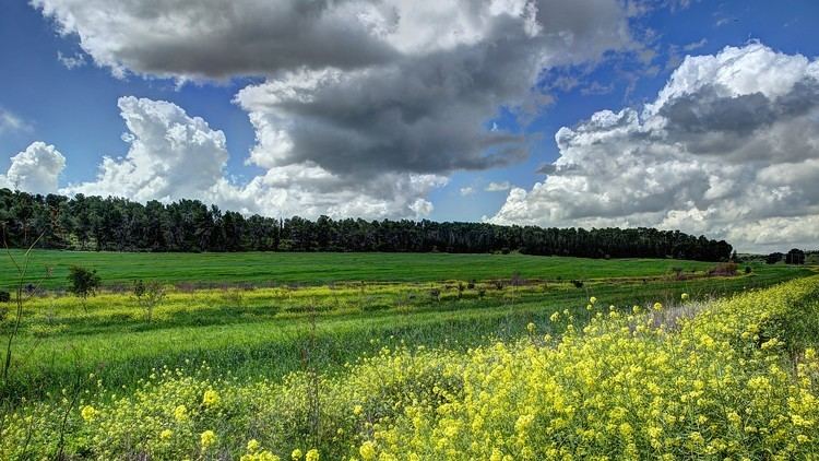
The Shfela, or Shephelah (Hebrew: הַשְּפֵלָה, also שְׁפֵלַת יְהוּדָה, Shfelat Yehuda, the "Judean foothills"), is a transitional region of soft-sloping hills in south-central Israel stretching over 10–15 km between the Judean Mountains and the Coastal Plain. The different use of the term "Judean Plain", as either defining just the Coastal Plain segment stretching along the Judean Mountains, or also including, or only referring to, the Shephelah, often creates grave confusion.
Contents
Today the Shfela is largely rural with many farms.
The Bible assigned land in the Shephelah to the tribes of Judah and Dan.
Geography
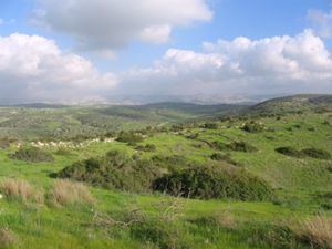
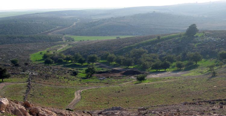
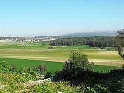
The Shephelah consists of fertile rolling hills. Topographically it represents the transition from the higher and more rugged Jerusalem and Hebron Mountains, whose foothills it forms, and the Coastal Plain. About 60 km (35 miles) long in north-south direction and only 13 km (8 miles) wide, it is subdivided into two parts: the western "Low Shephelah", which starts at an altitude of ca. 150 metres above sea level and rises to no more than ca. 200 metres above the Coastal Plain, and the eastern "High Shephelah" rising to altitudes between 250-450 metres above sea level. In the upper part the valleys descending from the Judean Mountains are deeper, and they broaden once they reach the lower part where the riverbeds create larger spaces between the hills. Where they reach the Shephelah, the rivers can flow over substantial distances along the border between the mountains and the hills, forming longitudinal valleys. Passage between the east-west and north-south valleys has dictated the communication routes throughout history.
In geological terms, the Shephelah is a syncline, i.e. it formed as a basin whose rock layers were folded downwards, but is part of the wider south Judean anticlinorium-a regional formation characterised by upward folding. Typical to the Shephelah are the Senonian-Eocene chalky formations. The soft Eocene chalk is known locally as kirton, which tends to build a harder upper calcrete crust (nari), so that in the past people quarried the kirton while leaving the nari layer in place as a ceiling. Apart from using the extracted rock, they also utilised the generated underground hollows for different purposes (refuge, burial, storage etc.).
One of the major characteristics are hills formed of marl-covered soft chalk, as opposed to the Judean Hills which are made of hard chalk and dolomite. The valleys and lower areas contain soil with a high sand content, as well as large tracts of fertile areas. Seasonal swamps can develop during the rainy season. The southern part is made up of loess, while north of Ashkelon consists of clay.
The Shfela has a temperate Mediterranean to semi-arid climate.
A series of east-west valleys cuts the Shfelah into districts. From north to south, they are: the Valley of Ayalon, Sorek Valley, Valley of Elah, Guvrin Valley, Valley of Lachish, and Valley of Adorayim. The biblical towns established there guarded settlements of the interior and took advantage of trade passing along this route. Ayalon was the primary access corridor to Jerusalem along the ascent of Horon.
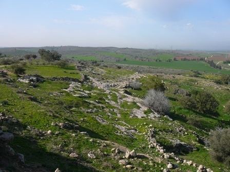
Caves are a major feature of the southern part of the Shfela, many of them bell-shaped such as those in Beit Guvrin.
History and archaeology
Archaeological surveys in the Shfela have found evidence of habitation during the Late Bronze period. The Shephelah was a border region between the Iron Age Kingdom of Judah and the Philistines. During the decline and ultimate destruction of Judah by the Assyrians and Babylonians, the region was taken over gradually by the Edomites and it became the core of what was known in Greek as Idumea. The Shepehelah flourished during the Hellenistic period, was strongly affected by the First Jewish-Roman War (66-70) and was largely depopulated of Jews as a result of the Bar Kochba revolt (132-136). It flourished again in the Byzantine period and was the scene of one of the major battles during the Muslim Arab conquest of the 7th century.