
Traversed by US 395 Elevation 1,959 m Range Sierra Nevada | Topo map USGS Toms Place Road U.S. Route 395 | |
 | ||
Location Mono County, California, US | ||
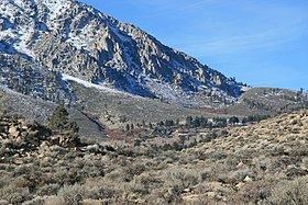
Sherwin Summit (el. 6,427 feet, 1,959 m) is a mountain pass on U.S. Highway 395.
Map of Sherwin Summit, California 93514, USA
It is located south of Tom's Place and Crowley Lake in the eastern part of the Sierra Nevada range. South of the summit, the road starts on its long 2,400 foot (610 m) descent into the 4,000 ft (1,200 m) high Owens Valley. The Owens River generally follows the road from this summit through the Owens Valley. Motorists who come from the south usually cross this summit in order to go to the high-altitude towns like Mammoth Lakes to the northwest to escape the smothering summer heat in the deserts. The pass receives snowfall during the winter, although the region receives relatively little precipitation annually.
References
Sherwin Summit Wikipedia(Text) CC BY-SA